Short workout ride on a Friday evening (have to remain in form). With a 600+ ft gain in elevation, climbing up from the dam below Stevens Creek Reservoir to the top of Coyote Ridge has the effect of stimulating the cardiovascular system somewhat. *wise ass grin* Technical-wise, Fremont Older is a beginner's ride: i.e. as long as you do not go off the w-i-d-e trails, descend faster than your skills (and equipment) allow, strip and dance naked in Poison Oak, etc., nothing bad will happen. On weekends, watch out for rangers with radar guns ($135 speeding tickets).
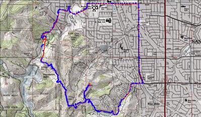
 Track log of the ride. Blue diamonds are track points, 568 of them.
 TOPO!'s elevation profile.
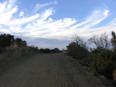
 From Stevens Creek Reservoir Park: dusty fire road leading up to Coyote Ridge.
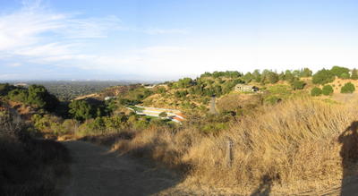
 View from halfway up.
 Top of Coyote Ridge (1000+ ft).
 View of Silicon Valley (eastwards) before descending to Prospect Road.
Hunter's Point: elevation 900 ft.
Sounds of laughter, shades of earth are ringing
Through my open views inviting and inciting me.
Limitless undying love, which shines around me like a
Million suns, it calls me on and on
Across the universe
Jai guru deva om
Nothing’s gonna change my world,
Nothing’s gonna change my world.
I had a good day.
Epilogue:
Total distance: Cyclo-computer 8.7 miles (13.92 km) / GPS 8.98 miles (14.37 km) / TOPO! 9.06 miles (14.5 km).
Total elevation climbed: Altimeter 1150 ft (350 m) / GPS + TOPO! 1029 ft (313 m).
Temperature range: 72 F (22 C).
Fluids consumed: <0.5 liters.

No comments:
Post a Comment