An adventure is only an inconvenience rightly considered. An inconvenience is only an adventure wrongly considered.(G. K. Chesterton)
Prologue
There's nothing like bouncing out of bed at 6 AM on a Sunday, having a large leisurely breakfast, 32 fl. oz. of thick, black coffee, listening to Johnny Cash, Nick Cave, Leonard Cohen, and Philip Glass, while leisurely preparing to ride up another mountain overlooking the Pacific Ocean. It's days like these that make life worth living.
---------
The drive from Santa Clara to Montara was estimated to take 57 minutes, but little did I know that westbound Highway 92 from Highway 280 is part of the AIDS/LifeCycle 5 route to Los Angeles — which kicks off today. As a result, I got to experience what it was like to drive from Highway 280 to Highway 1, via Highway 92, in 1st gear at 5 mph (8 km/h). Whoopie.
 During the hour-long drive on Highway 92 (#@%&!!!), I had plenty of time to observe the AIDS/LifeCycle 5 participants. Check out the guy wearing the fairy wings near the Call Box. Pity him not for his fashion faux pas but his ignorance of aerodynamic forms and efficiency. Riding 585 miles (936 km) to Los Angeles in that, along the windy Highway 1, he is going to experience a rude introduction to the concept of air resistance.
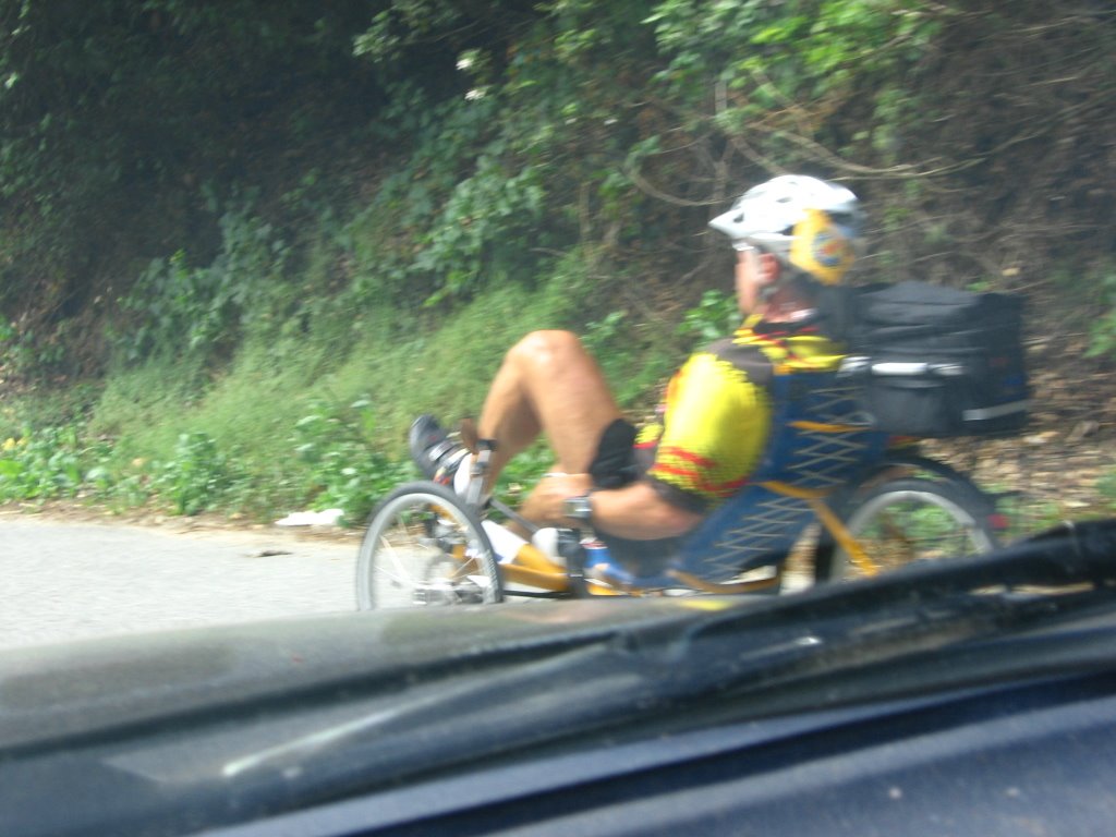 It is painful watching recumbent cyclists on uphills. They look like a man thrashing in labor. Not a pretty sight. They really fly on the flats though.
 Maybe it's my mountain biking and bicycle touring roots but I must admit, the idea of supported rides (i.e. your luggage is carried by vehicles ahead of you; you have meals ready for you at major checkpoints; smaller, more frequent checkpoints top up your water bottle) just doesn't appeal to me. It seems to be the equivalent of walking around the zoo, checking into the Hilton at the end of the day, and then considering having toured the wilderness.
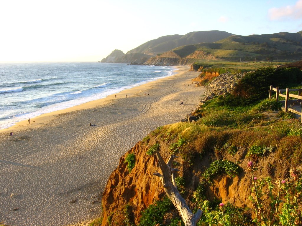
 Montara State Beach. One could park 0.5 mile further north but the lot is unpaved. Calling a tow truck out here to yank your vehicle out of the sand will be prohibitively expensive.
 My vantage point. A sheer 50 ft drop lies just beyond. A little dicey with thistles and poison oak too, but a nice place to take shots.
 Close up of the flowers — taken in the evening, after I returned from my bike ride (in case you are wondering about the warmer colors).
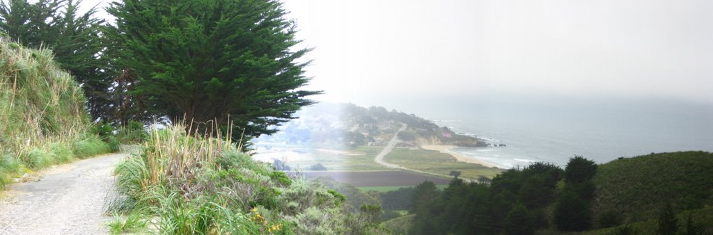
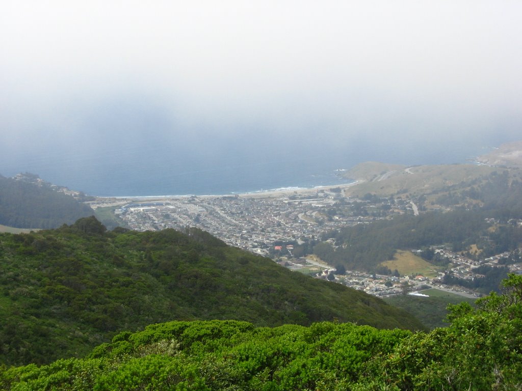
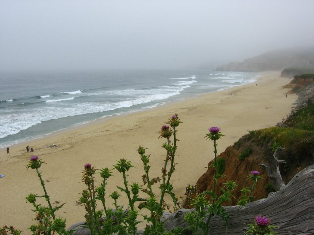 Most of Devil's Slide promontory is hidden in the fog.
 The fog didn't stop the surfers though.
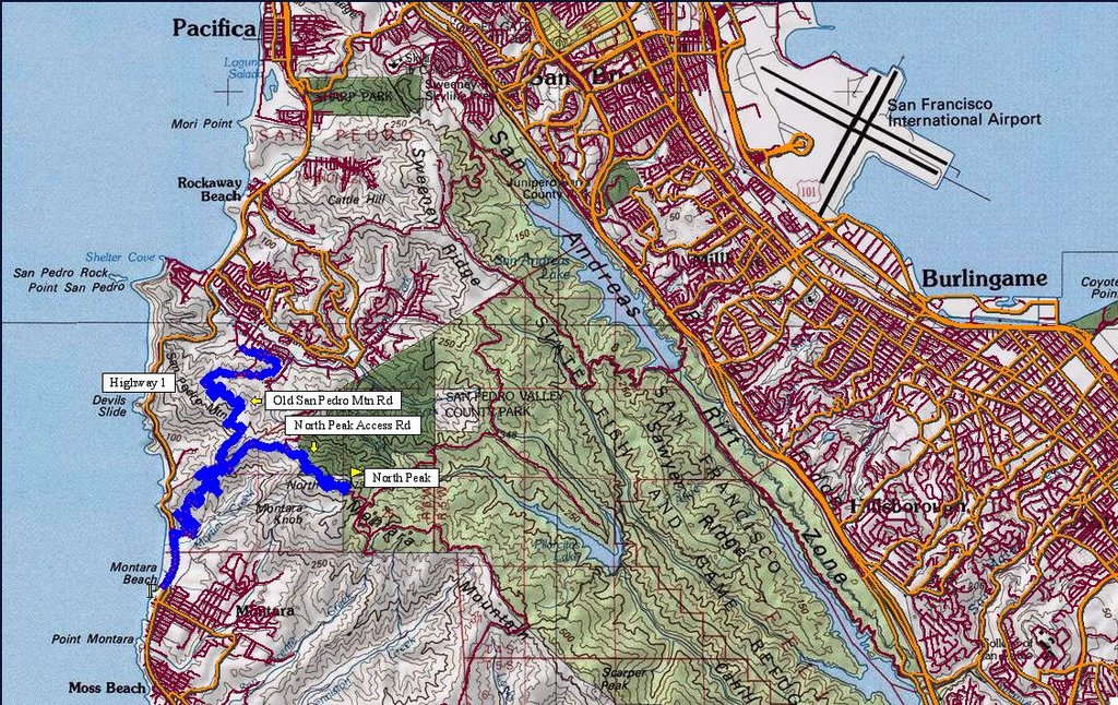 Level 4 TOPO! map of today's ride. Refer to the level 5 (following) map for more detail.
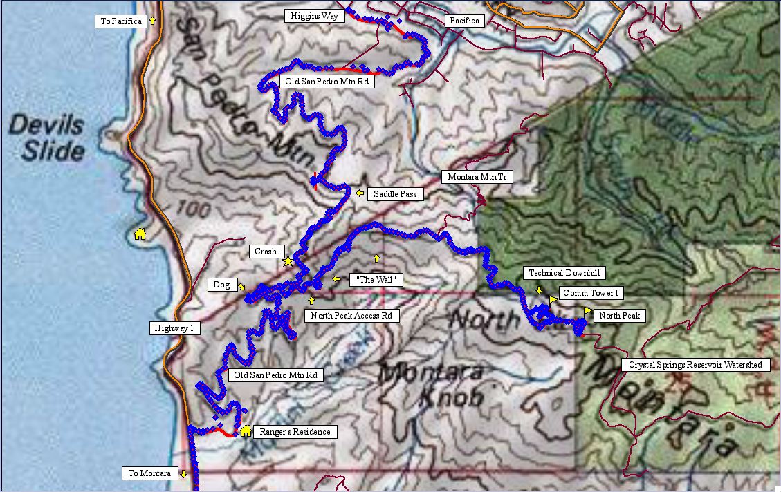 Map of today's ride. 1980 track points (blue diamonds) laid by the GPS unit.
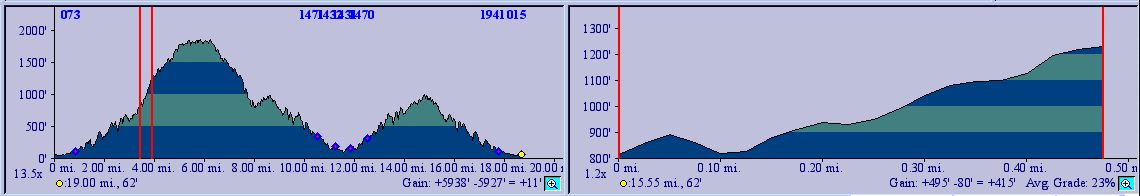
 TOPO!'s elevation profile.
 The trailhead (to the right) lies a 1/4 mile after the barrier marking the southern end of Highway 1's closure between Pacifica and Montara.
 Trailhead.
 The southern flank of Mount Montara is also known as McNee Ranch State Park.
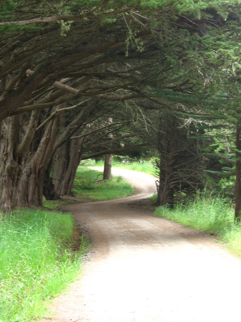
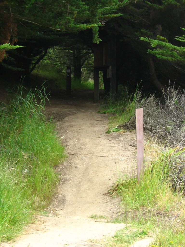 This gorgeous trail is the Gray Whale Cove Trail. It is not bike legal (though I do observe bicycle tire tracks on the dirt. Hohoho!)
The image above shows the Overlook ridge in McNee Ranch State Park. Highway One is in the foreground; Gray Whale Cove Trail can be seen winding above the Highway. Montara State Beach is to the right, Gray Whale Cove State Beach to the left. The Martini Creek watershed is on the right, Green Valley on the left. The ridge road at the top center continues on to the peak. Photo courtesy of Bill and Barbara VanderWerf.(Source)
 After this section is the ranger's residence. Take a left there.
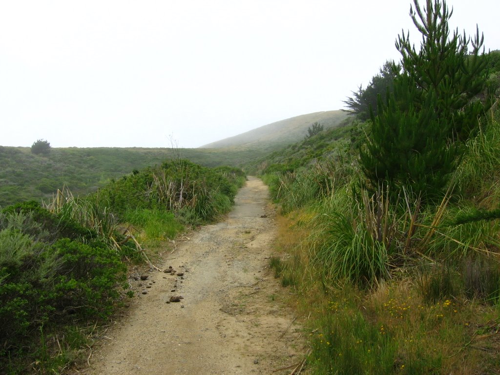 So here am I climbing Mount Montara, as the Spanish explorer and governor of Baja California, Captain Gaspar de Portola, did in 1769 (except that I'm pretty sure he didn't have a mountain bike).
 Here and there, the asphalt has broken down into sand.
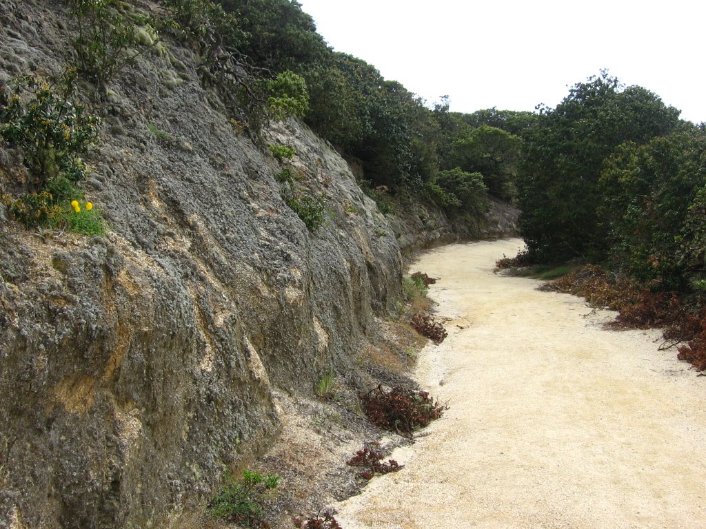
 This trail is known as Old San Pedro Mountain Road.
Old San Pedro Mountain Road runs north along the western side of Montara Mountain from the town of Montara to Pacifica. As the name suggests, it was once an automotive route between San Francisco and Half Moon Bay. Known as Coastside Boulevard, it opened in 1915 and was abandoned in 1937 in favor of the "new" state highway, Highway 1, although some folks used it until after World War II. The trail that exists now is made up of sandstone and deteriorating asphalt. Every winter, a little more of the asphalt gives way to dirt.(Mountain Biking Northern California's Best 100 Trails, Delaine Fragnoli and Robin Stuart)
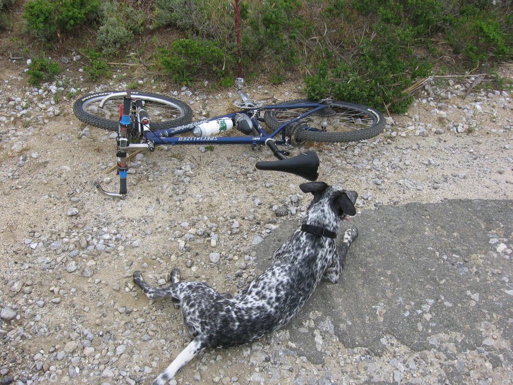 Elevation 800 ft: this strange dog came bounding out of the bushes towards me. He was neither aggressive nor foaming at the mouth, so I stopped to see what he wanted.
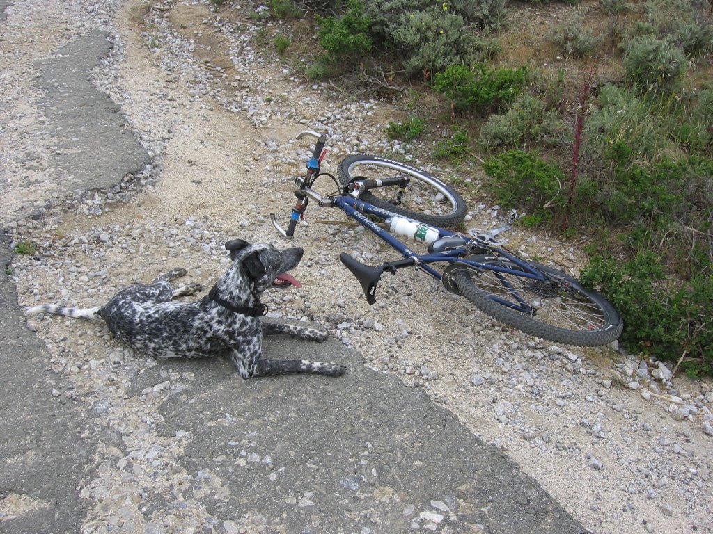 What are you looking at, boy? Hmm?
 You are thirsty?
 All right, here you go.
He seemed really thirsty. I gave him 1/2 the contents of my water bottle (8 fl. oz.). We waited 15 minutes for his owner to show up (the dog had a collar). After that, I figured I had a lost dog on my
 But a 1/4 mile down, as I was taking this composite picture, the dog disappeared. Well! So I climbed up again.
 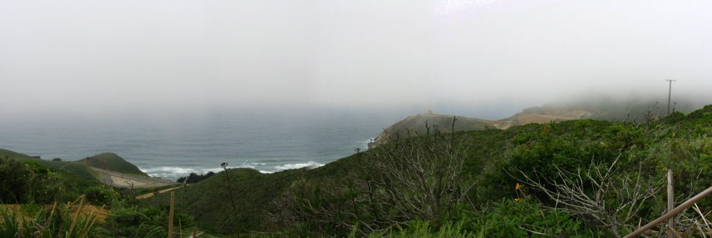 Taking another composite picture before I get started climbing the section affectionately dubbed as "the Wall," a rutted, loose and sandy section that rises 500 ft in 0.5 mile. The road below is Highway 1. On the right is the beginning of Devil's Slide, a notoriously unstable section of the highway. It is not uncommon to have rocks drop from the steep slopes of San Pedro Mountain onto the roadway, or have parts of the road fall into the sea. More than a few motorists have found out, much to their sorrow, that speeding round those curves when the going is wet (e.g. rain, fog), why swimming in the Pacific Ocean with their vehicles isn't a popular sport.
 Look who shows up again! The strange dog decides to accompany me to the summit.
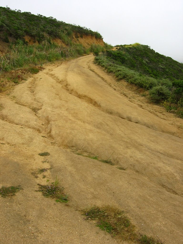 And so it begins...
The start of "the Wall."
 TOPO! estimates "the Wall" to possess an average grade of 23%.
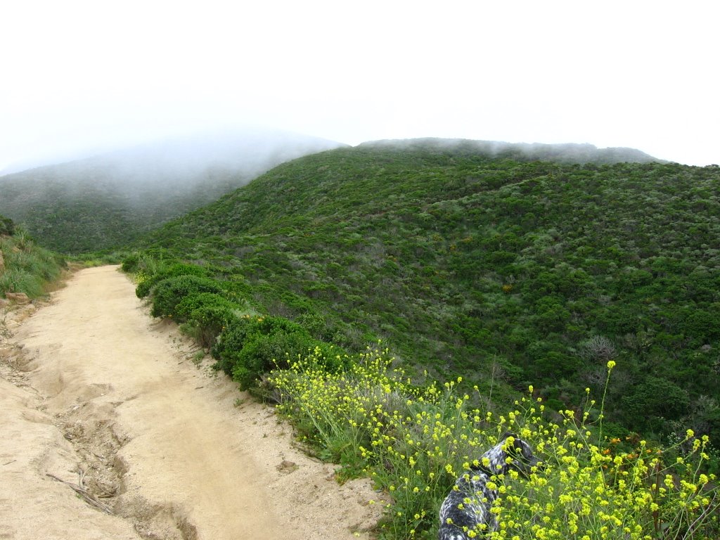 Ack! Dog! Out of my way!
 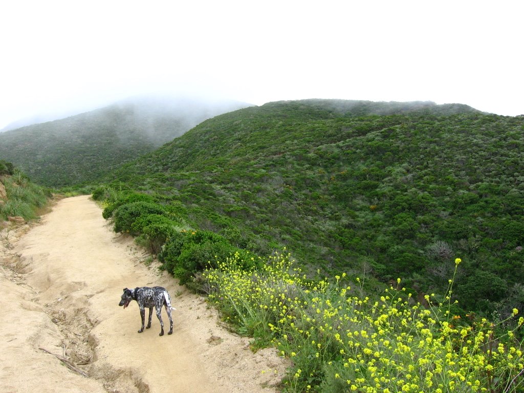 DOG: Hurry up! We haven't got all day!
 Looking down.
 While struggling to maintain traction on the rear wheel, my front wheel wandered into one of these ruts and it was all over. It's hike-a-bike for the remaining 1/3 of "the Wall" now.
 Soothing my bruised ego by pretending I am a photographer with a mountain bike, rather than the other way round, here's looking down at the Martini Creek Watershed.
 Flowers I: California Poppy (Eschscholzia californica).
 Old San Pedro Mountain Road continues on the left to Pacifica, while North Peak Access Road on the right ascends to the summit.
 North Peak Access Road possesses denser foliage (coastal scrub and manzanita) and is picturesque in its own way, often with wildflower-adorned granite rock walls on one side.
 Granite outcrops along the ridge where North Peak Access Road runs.
 Some portions of North Peak Access Road are just bare granite, like this steep section.
 Flowers II: Blue Bush Lupine (Lupinus propinquus). This shrub, a member of the pea family, attracts butterflies.
Blue bush lupine stands out when its multiple branches carry candle-like clusters of blue-purple flowers in May and June. These flowers open over a period of several weeks, decorating the hillsides when many early spring wildflowers have already passed.(Keator, Glenn, Linda Yamane, and Ann Lewis. In Full View: Three Ways of Seeing California Plants. California: Heyday, 1995. 48.)
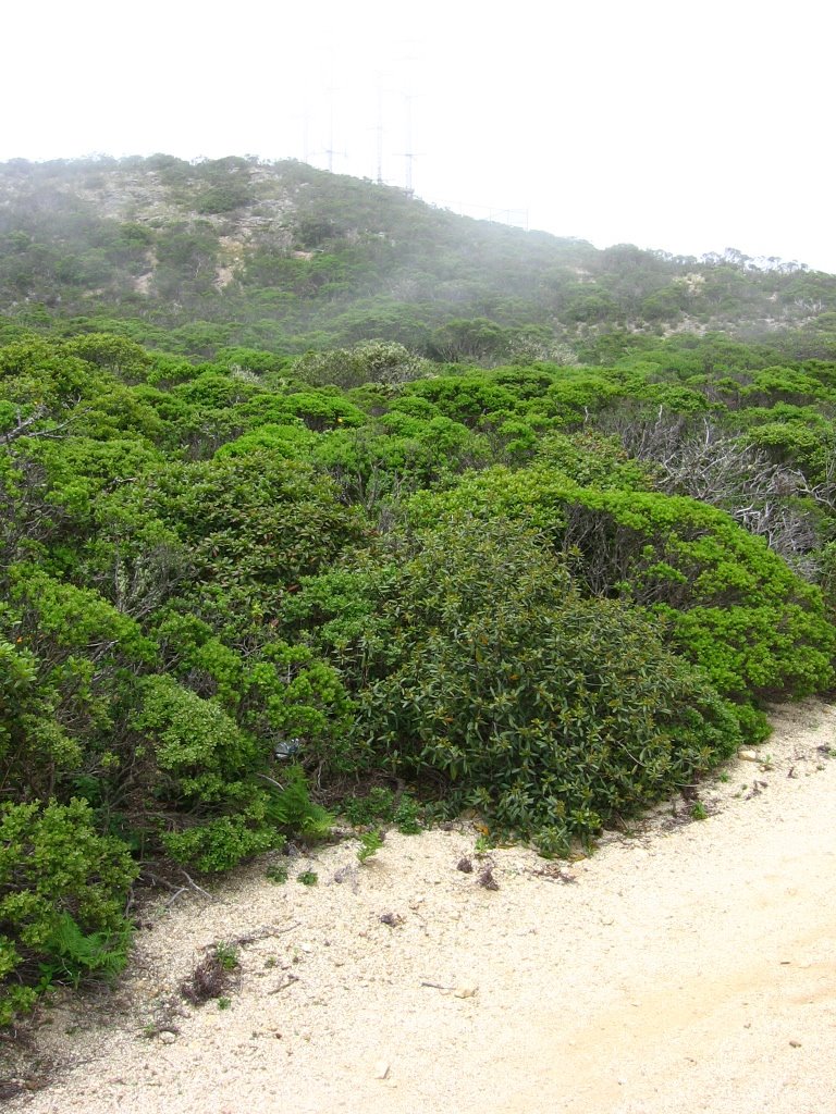 Communications Tower I.
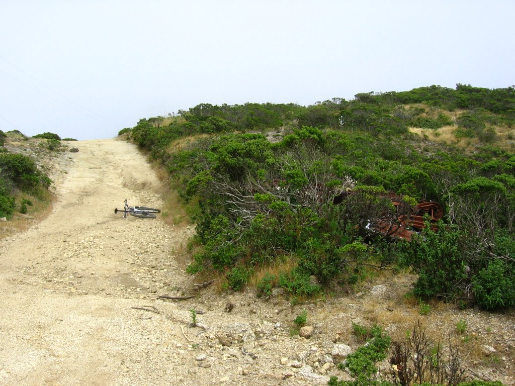 Wrecked vehicle on the right.
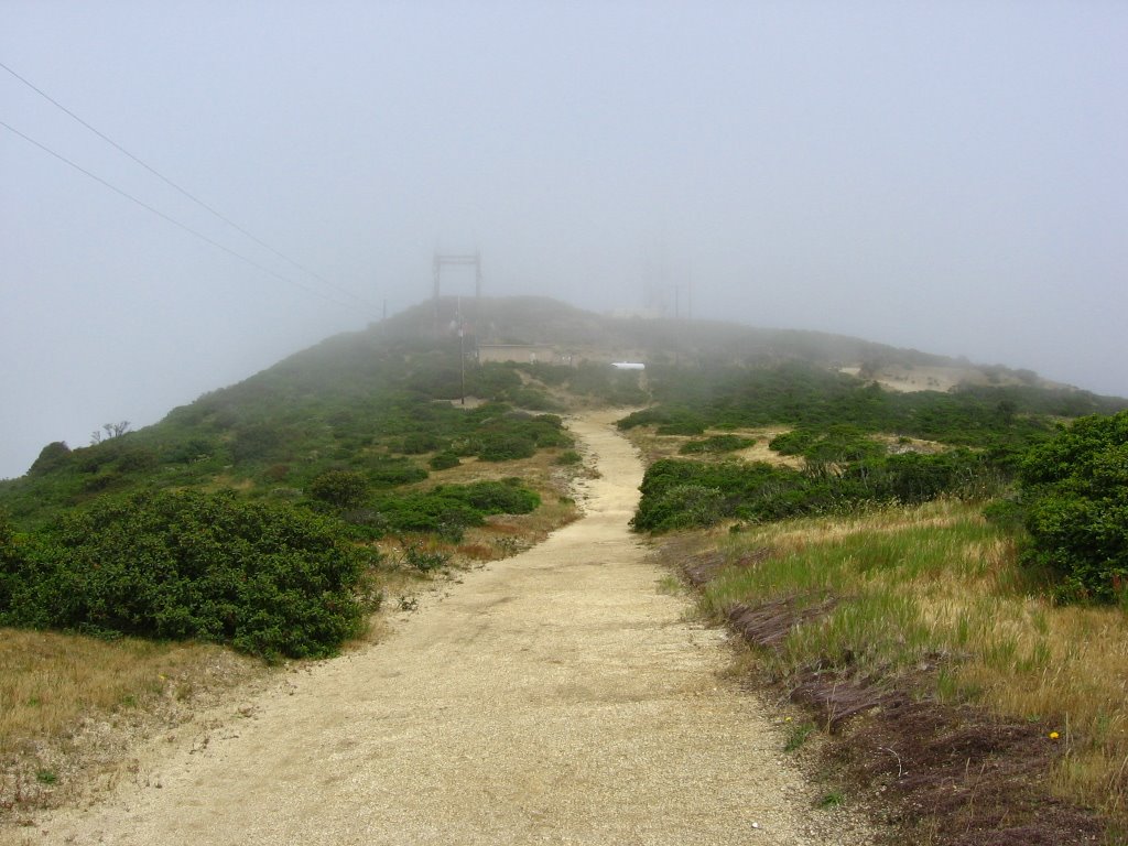 Communications Tower II, North Peak.
 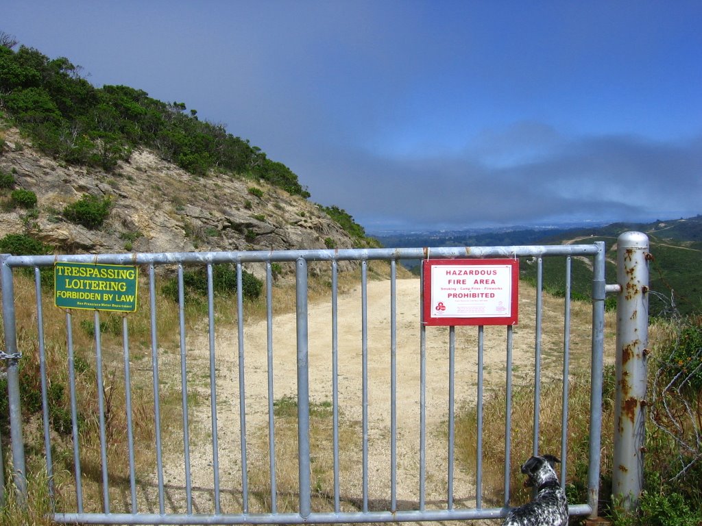 North Peak Access Road dead ends at this gate. Beyond lies the Crystal Springs Reservoir Watershed. "Spot, the Wonder Dog" (a nickname I gave him for his ability to effortlessly leap over bushes and boulders just for the heck of it) checks out the scenery.
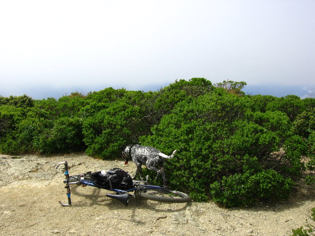 Elevation 1898 ft: North Peak of Mount Montara.
Spot is trying to tell me he wants more water. I had given him all the water in my water bottle, so I taught him how to drink CytoMax energy drink from my Camelbak. He was hungry too and was trying to eat twigs and deer droppings. Yuck! I stopped him, forfeited my lunch, and gave him my Clif Energy Bar, which he ate with gusto.
 USGS marker.
For the pedantic, North Peak (1898 ft) is not the highest point of Mount Montara. That honor belongs to the 1944 ft Scarpet Peak (37.52889, -122.42611). However, it lies within the Crystal Springs Reservoir Watershed, and so, is off-limits. The water in the Crystal Springs Reservoir is exceedingly pure, requiring practically no treatment. The stiff restrictions were probably implemented in the attempt to keep it that way.
360 degree QuickTime VRs taken from another, slightly lower peak with no structures, 1625 ft Montara Knob (37.55694, -122.48389): QTVR 1, QTVR 2.
 Looking north at Pacifica.
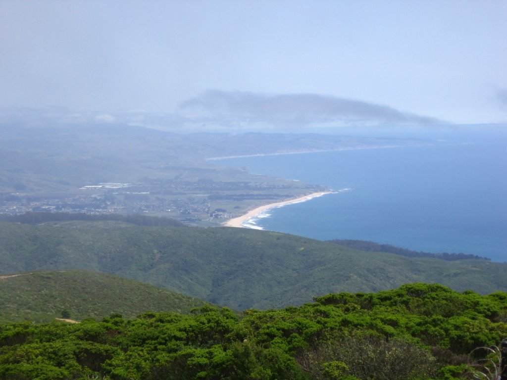 Looking south at Montara.
 Salamander.
 Composite picture 1: looking north, Pacifica.
 Composite picture 2: looking east, Sweeney Ridge.
 Composite picture 3: looking south-east, Sawyer Ridge.
 Composite picture 4: looking south, Montara, and further south, Moss Beach.
 Climbed up the rockier Communications Tower I. Communications Tower II can be seen in the distance, as well as the summit of North Peak behind it.
 Flowers III.
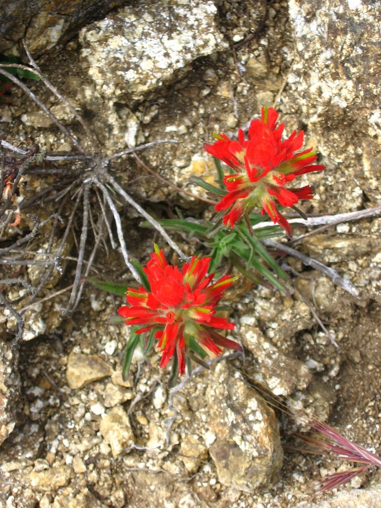 Flowers IV.
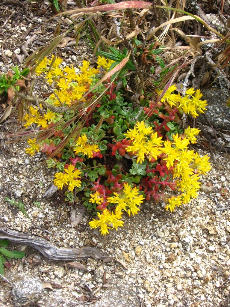 Flowers V.
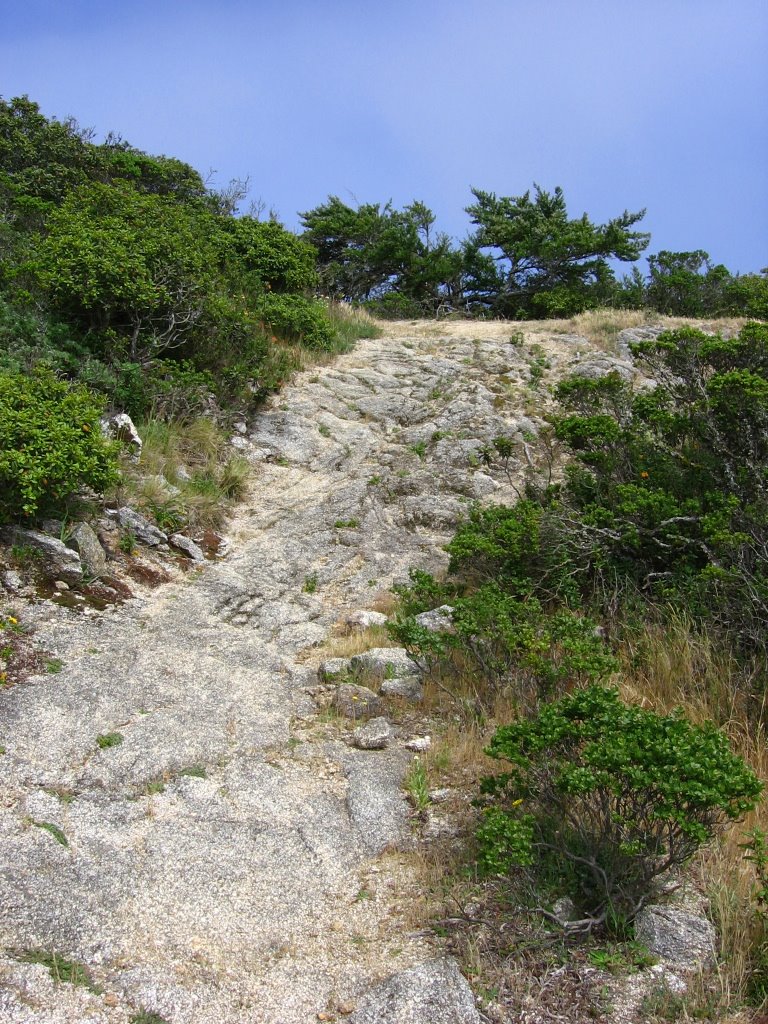 Discovered a technical downhill section from Communications Tower I. This is the beginning of it.
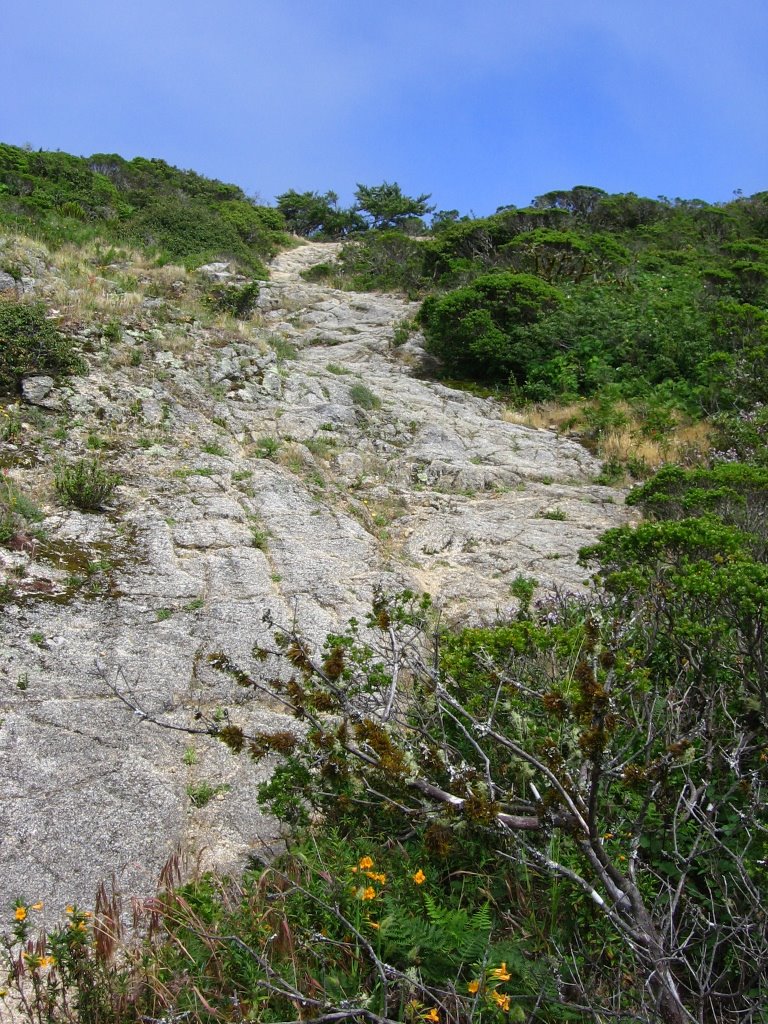 The rest of it. *Gulp!*
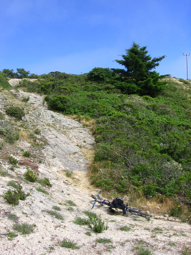 I don't know what drove me to do it, but I did it. My heart was pounding and I was dancing around, hooting and yelling after pulling it off. My only audience was Spot, the Wonder Dog. He let me hug him in joy.
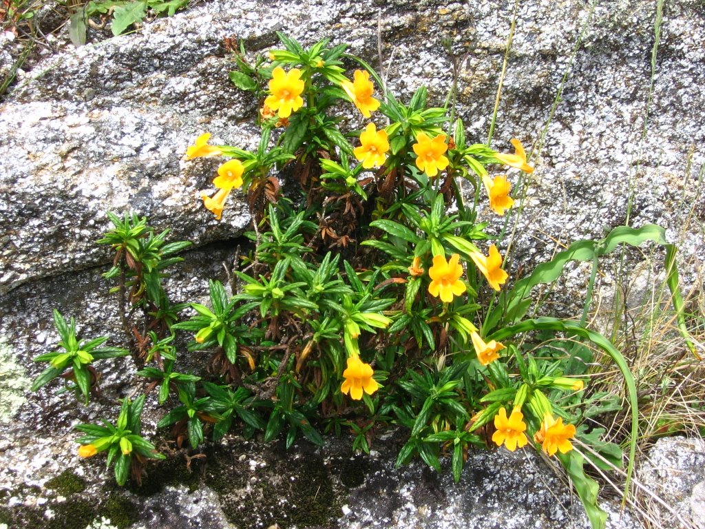 Flowers VI.
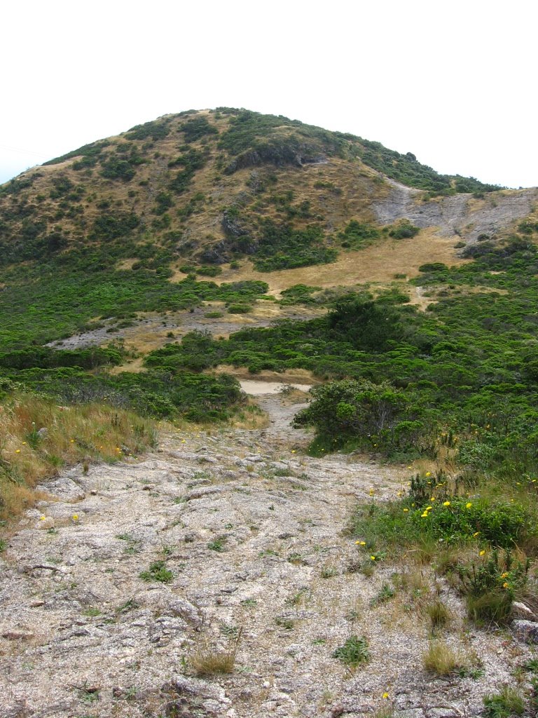 Part 2 of the technical section daunted me. I thought long and hard about it (longer than over Part 1), but ultimately decided against testing my luck again. With no body armor and knee guards, I could easily smash something on the unyielding granite if I fell. That, and the $5000 deductible for my medical insurance isn't — How does one put it? — confidence-inspiring.
 After walking down with my bike and looking up, I think I made a wise decision.
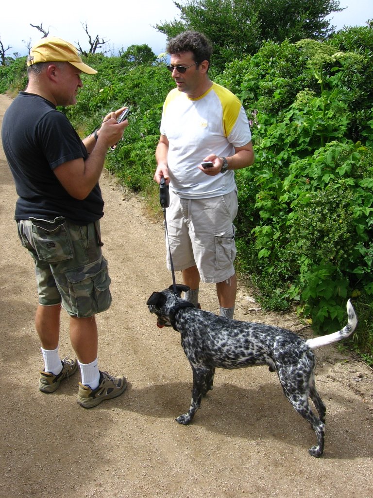 Going downhill — slowly, so that Spot can keep up. (Dogs will run themselves to death just to follow you.) — I met 2 hikers with their dogs. They recognized Spot. It seems that his owner lost him early this morning and has been at the foot of the mountain begging hikers to keep an eye out for the adventurous dog. It was then I found out Spot's real name: Oreo. LOL!
 Here, they are trying to call the owner on a cell phone. They had to leash
 Alone again, I continue along the rollercoaster descent of North Peak Access Road, skidding round corners and generally trying not to get myself plastered on the walls.
 The fog has partially lifted. Mount Tamalpais (1), (2) can be seen in the distance.
 Close up. The little "bump" on the extreme right of the range is East Peak (2572 ft), the middle "bump" is Middle Peak (2516 ft), and to the left of it is West Peak (2574 ft).
 To the east, across San Francisco Bay, the 3849 ft Mount Diablo (1), (2) comes into view.
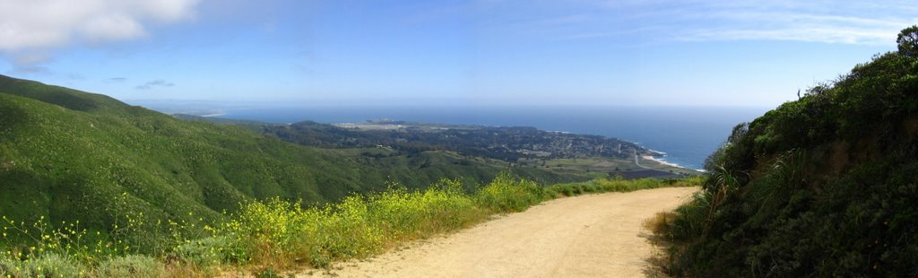 Continuing the descent of North Peak Access Road.
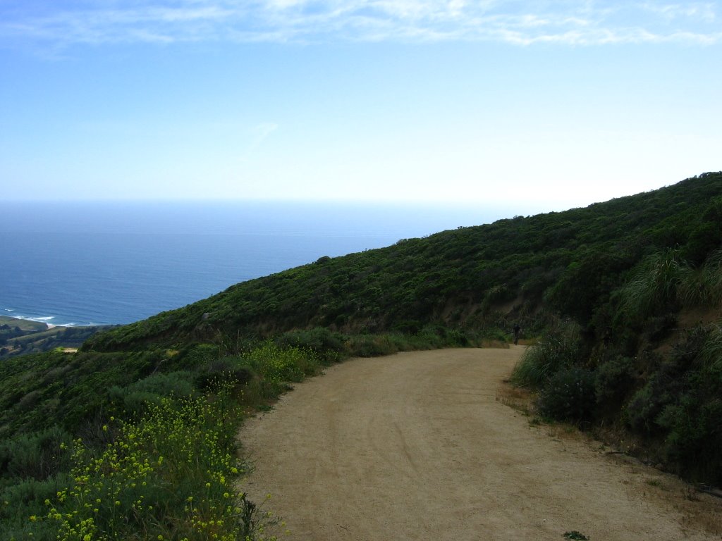 A mountain biker climbing up the last section of "the Wall."
 Further down, another mountain biker pedaling up. He is about to climb "the Wall."
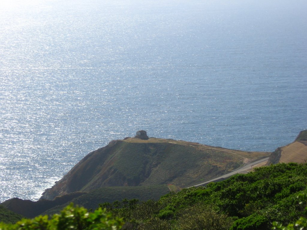 An interesting place for a building.
 Getting on the rest of Old San Pedro Mountain Road to Pacifica to take a look.
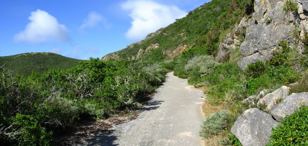 Wider view.
 In some sections, the formerly wide road has deteriorated into quasi-singletrack, sometimes with rather hairy exposure.
 After cresting Saddle Pass, Old San Pedro Mountain Road begins a gentle, if sinuous, descent to Pacifica.
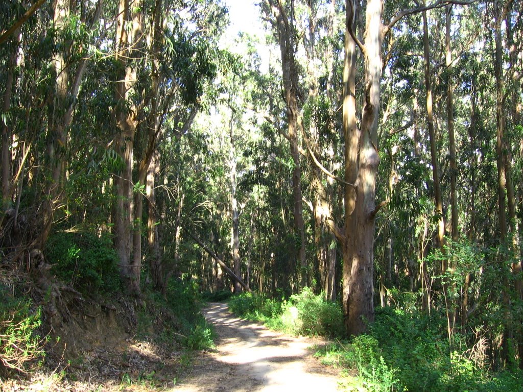 The last mile winds through a cool eucalyptus forest.
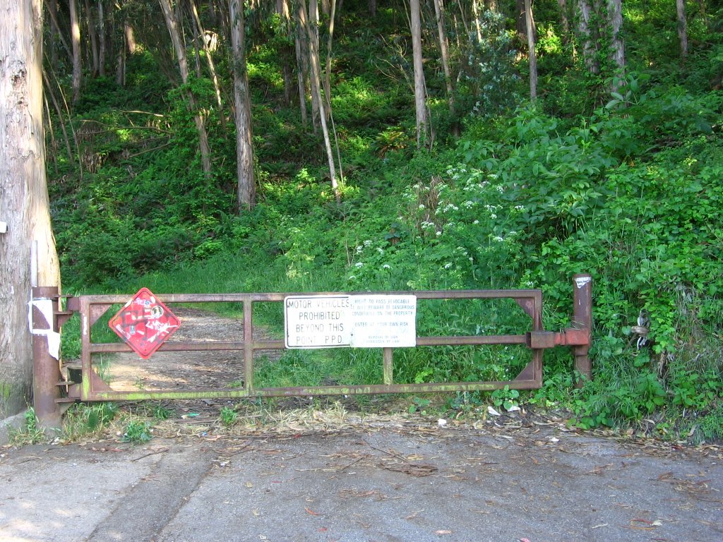 Northern trailhead of Old San Pedro Mountain Road, located at the end of Higgins Way in Pacifica.
 Climbing back up to Saddle Pass (930 ft), I decided to go exploring and discovered some nice singletrack.
An excerpt from the park brochure:
Sections of McNee Ranch and Montara Mountain are very remote — do not follow "renegade" trails or wander off the marked trails — unless someone knows where you've gone and when, it may take days or even weeks for a rescue or search team to find you.
 Met Rick, a resident of Pacifica. He rides a nice vintage 1994 Ibis Mojo. In the picture, he's off to climb up San Pedro Mountain (left).
 Composite satellite imagery of the general area.
 Monkeying around with my bike.
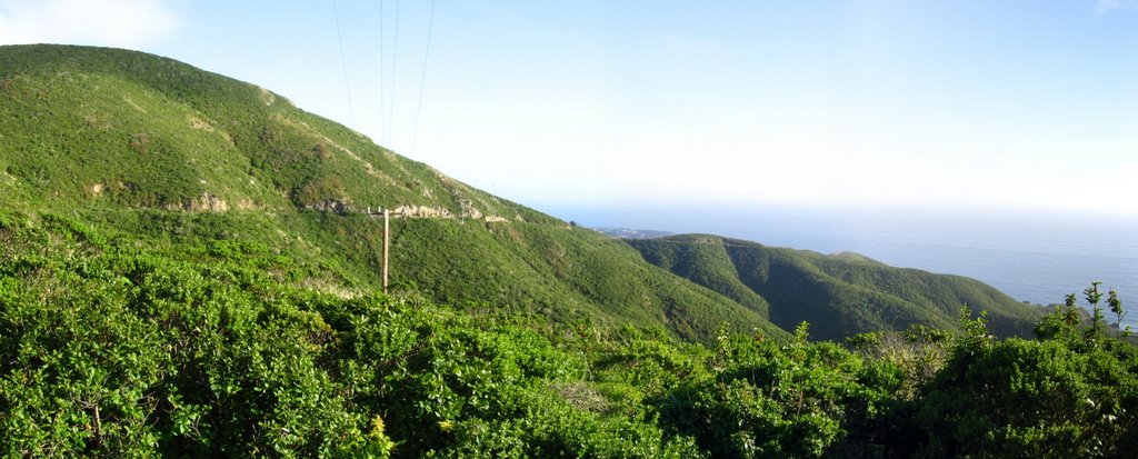 Looking at Old San Pedro Mountain Road descending from Saddle Pass to Montara. To the right is Green Valley.
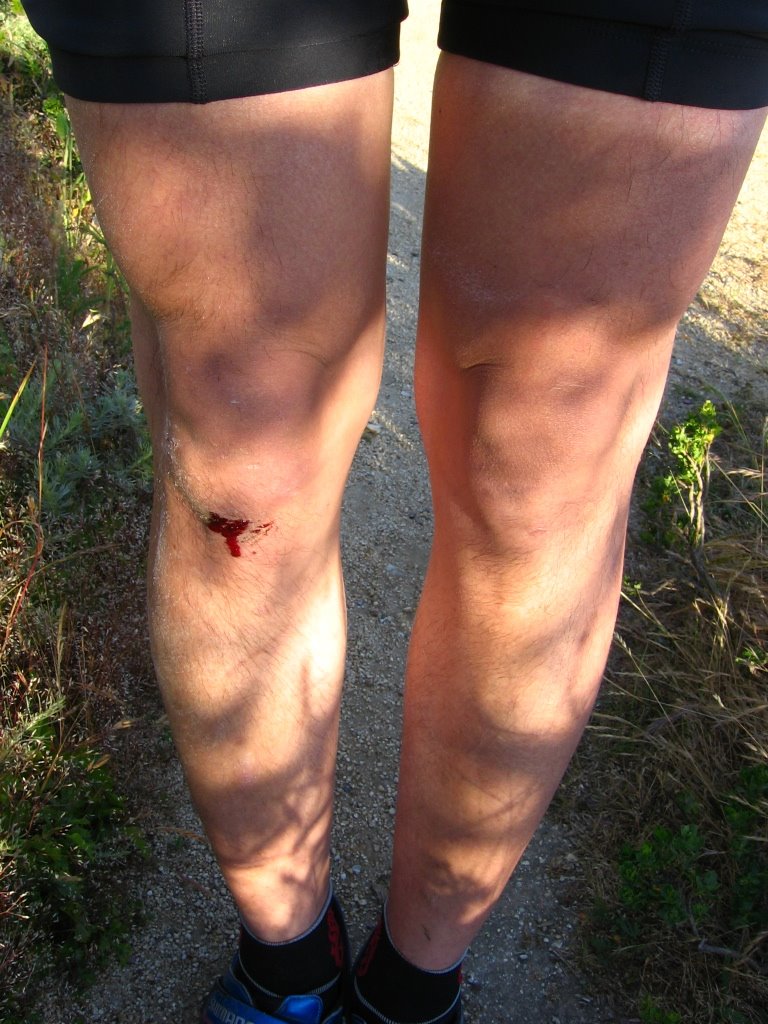 What you get for daydreaming while descending. My Camelbak took the brunt of my crash though. Whew!
Rant
Don't you hate it when you crash and one or more of your clipless pedals fail to release? As if the crash wasn't ego-wounding enough, you have to be lying on your side with either or both of your lower limbs still solidly attached to the pedals. All you need is a Monty Python score playing as you struggle to reach down with both hands to twist your toes inwards and heels outwards to release your foot / feet. Bonus points awarded if you are lying on thistle or cactus.
 Took some singletrack on the way down.
While putting my bike in my car, a car pulled up behind me, and a rather distressed-looking gentlemen exited his vehicle and rushed into the Porta Potty. A moment later, he emerged, still anxious (there is no running water in there). Lifting the hood, he stood there looking at his M3 as it bled coolant onto the asphalt. That was when the female in the passenger seat started screaming at him not to stand there like an idiot and do something. So, he approached me for help. I gave him a gallon of Prestone 50/50 pre-mixed coolant and some hose clamps. As the plastic inlet pipe to the top of his radiator was broken, there was nothing else I could do apart from suggesting that it would probably be cheaper for him in the long run to have his vehicle towed back to San Francisco rather than risk a warped cylinder head. A passerby concurred.
As he walked back to his vehicle, his well-bred (and well-dressed) female companion began yelling that he better hurry up because she is getting bored.
Times like these make me want to want to hug my bike.
 The 2 diversions today (lost dog and stranded motorist) meant that I would not make it back in time for the 10 PM mass--much less the 8:30 PM choir practice — in Santa Clara, but as the English dramatists, Francis Beaumont and John Fletcher, wrote in Lover's Progress, "Deeds, not words." And so, I lingered around to partake in the sunset instead.
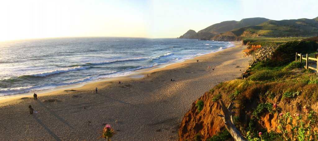 Wider view.
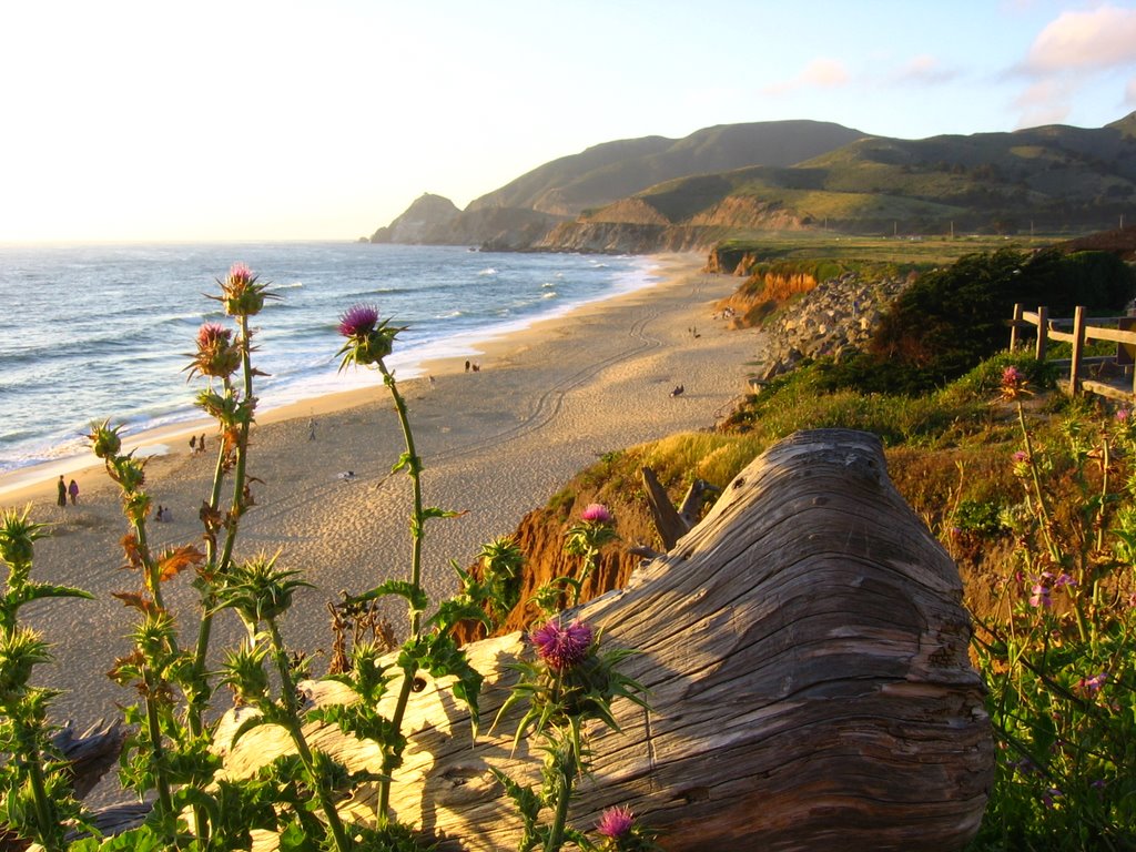 Everything takes on a tinge of gold in the evening sun.
Nothing is so beautiful as Spring —(Gerald Manley Hopkins)
When weeds, in wheels, shoot long and lovely and lush;
Thrush's eggs look little low heavens, and thrush
Through the echoing timber does so rinse and wring
The ear, it strikes like lightnings to hear him sing;
The glassy peartree leaves and blooms, they brush
The descending blue; that blue is all in a rush
With richness; the racing lambs too have fair their fling.
 Walking down to Montara Beach.
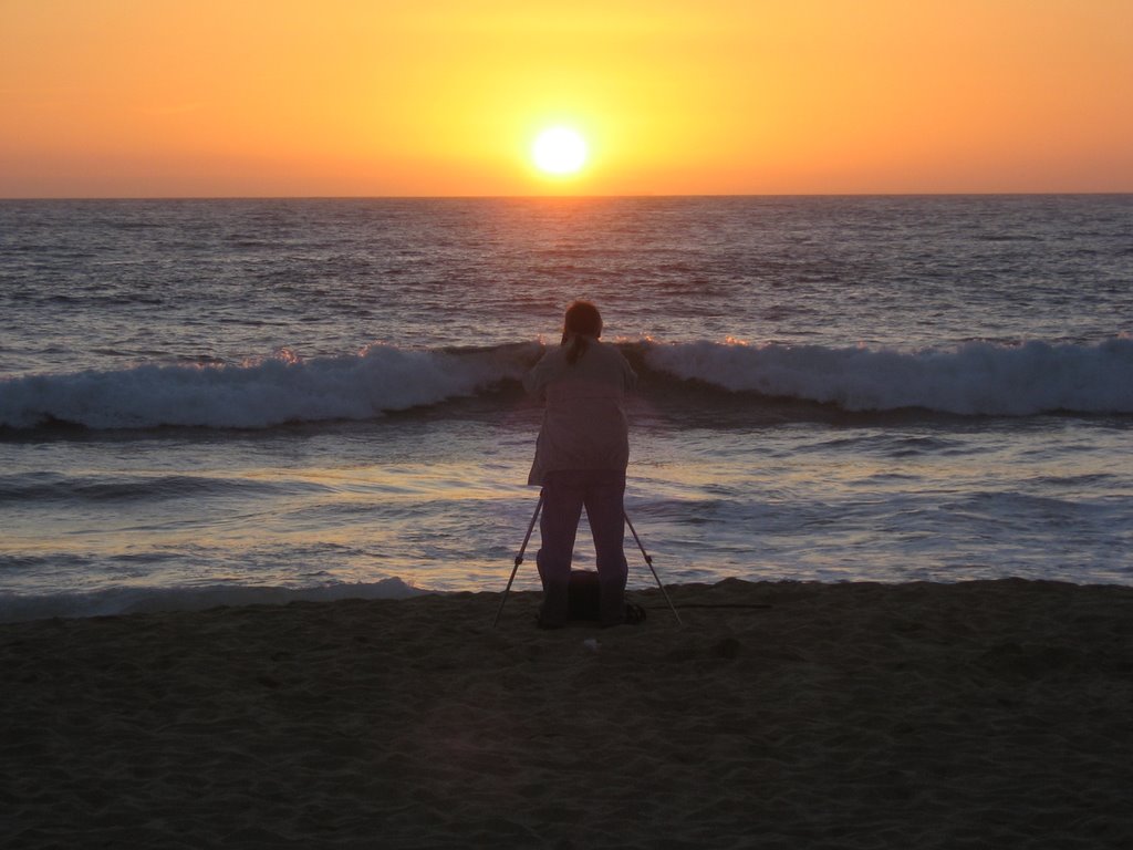 Photographer and sunset.
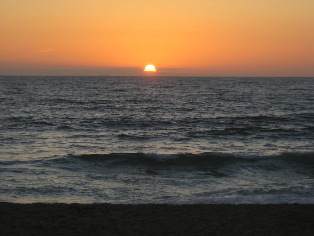 With my toes burrowing in the sand...
Epilogue:
Total distance: cyclo-computer 19.3 miles (30.88 km) / GPS 19.52 miles (31.23 km) / TOPO! 18.8 miles (30.08 km).
Total elevation climbed: Altimeter 4270 ft (1301.8 m) / GPS + TOPO! 4098 ft (1249.4 m).
Temperature range: 60 F to 68 F (15.6 C to 20 C).
Fluids consumed: 28 fl. oz. of CytoMax.
Ride conducted solo.

5 comments:
Cuzz!!!! Once again...the pics are simply..magnificent and mind-blowing!!!!!! I would like to seek permission to save all these pics in my online photo album please?? pretty please??? *Muah* he he
Joe,
Yes, but I don't eat dogs. I love to pet them though.
There is no technical downhill from Comms Tower #2 (unless you plan on riding through bushes and shrubs).
Cuzz x2,
Glad you like the pics!
Sure, cuzz! :-)
Great pics...I'm going up there soon with a bicycle bullet cam for video...I gotta do a downhill video of this soon
www.bluoz.com/blog
jeff
downhill done!.....very nice view from up there. I believe I went to the exact same place as your photo of the marker...At the radio towers...Currently procesing the video and this might take a day or two, but for right now i have a short video from the top > http://www.bluoz.com/blog/
also, there is a serious technical downhill that's unmarked, and much worse than 'the wall'..It's unmarked and starts about 1/4 the way down and is a shortcut to get down to Saddle Pass..In Fact, it starts at Saddle Pass and goes up to the main access road.. It's one way to avoid that switchback, but that's serious technical stuff, because I climbed up it. If that's the same thing you mean, you're right, it was wise not to go down that...You need gear, disc brakes, a good bike, shocks...even then there are 4-5 feet drops, and you'll endo for sure unless you're good...You also need long sleeve shirt, because poison oak in some places only 18 inches to get through..Both you're handle bars plow through it..
Nevertheless, people obviously do it because I saw bike tracks all the way up..it's about 1/4 mile of pure hell 40 degree angle I think...granite on half of it..
I did not go back down that way as it was a mountain climb just to get up it..I mean, you have to lift your bike up..
still, I have a nice downhill video now of most of what you have done here, the same path, excpt for that swithcback .
big fun...jeff
Thanks for the cool video, Jeff!
Ah, it brings back memories of Oreo and "the Wall."
I don't remember any drops in the technical section from the first communications tower, but it was steep all right. Some riders I spoke to told me of a technical section that was kick butt. I guess that is what you found.
Good riding!
-ben
Post a Comment