Lunch, the long drive up from Santa Clara and the visit to the lighthouse, south, north and Drake's beach, left me with precious little time before sunset (4:51 PM), so a short ride will have to do for today. Enter Bull Point Trail, a doubletrack to the heart of Drake's Bay. Of the three routes leading to Drakes Estero, Bull Point Trail is the easiest yet most remote. The trail traces the eastern bluffs of Creamery Bay, wandering through open pasturelands--and grazing cattle--to expansive views of Drakes Estero and Drakes Bay: enormous saltwater and freshwater bays home to a huge variety of shorebirds and waterfowl.
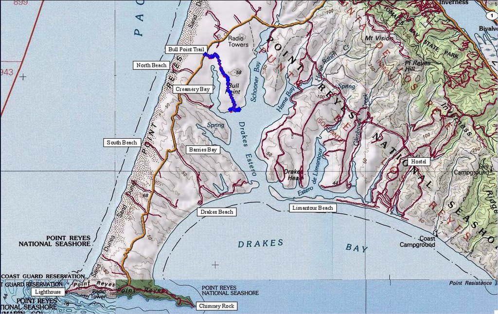 Map of the local area and trail. 193 track points laid by the GPS unit.
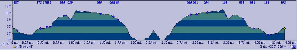 TOPO!'s elevation profile.
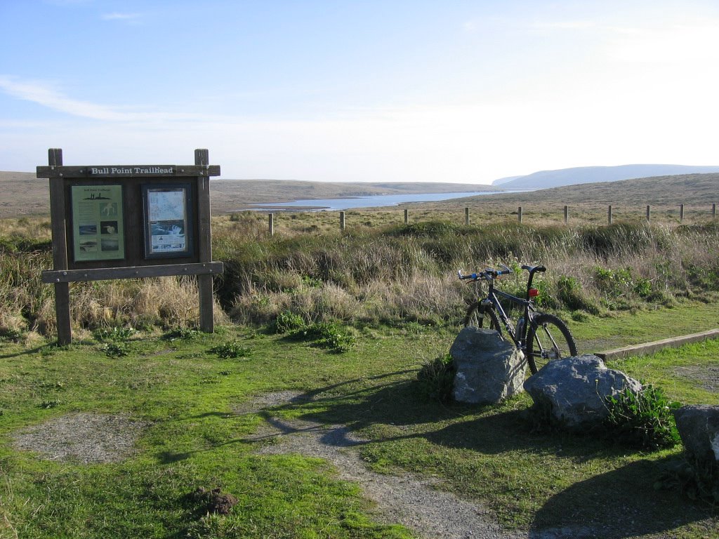 Trailhead. The body of water is Creamery Bay.
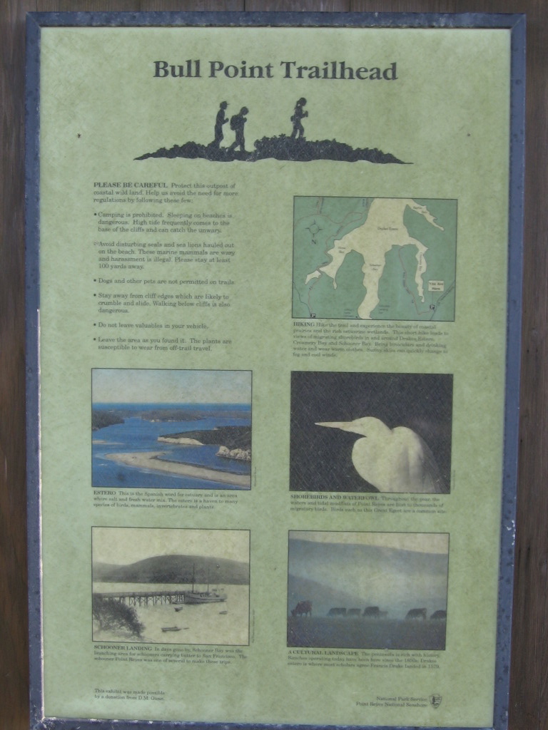 Some info about the trail.
 While the trail isn't technical, it could hardly be described as a smooth ride. The entire trail was pockmarked with depressions caused by the passage of countless cows. Yes, it was a bumpy ride. The cow pies are about the most difficult obstacle on this trail.
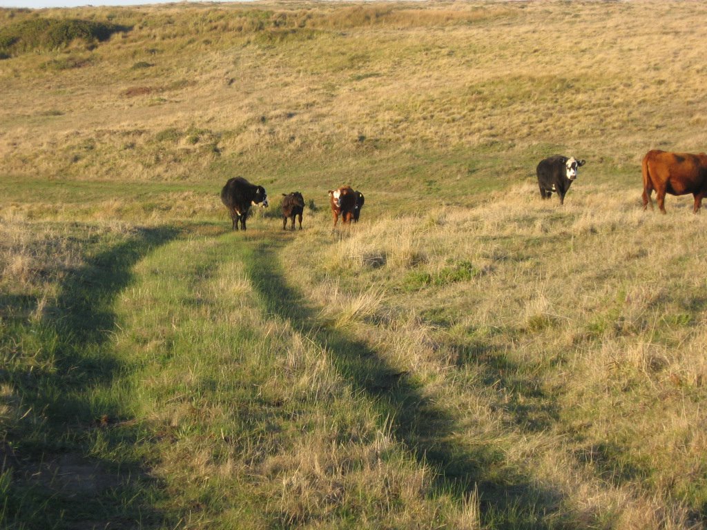 One other obstacle on this trail (besides cow pies): cows. The regular ones stare at you until the last few seconds before moving off grudgingly. The sneaky ones leave a steaming pile of sh*t for you to run over. Now, the psycho ones. Those are nuts. Not only do they refuse to move, but as you get closer, they try to headbutt you. Now, when you are talking about a 1500+ lb animal, their head can weigh as much as 150 lbs (my weight after a big meal): a headbutt will probably do some serious damage. I don't care how tough you are or you are 50 cent's twin, Moo Moo Cow here and her headbutt will send you flying. Maybe I can wear an Outback Steakhouse or a Black Angus Steakhouse jersey to let them know who they are dealing with:
Just a cyclist?
JUST a cyclist?
I had your sibling for dinner last weekend!
Naw git de hell otta mah way!
Or, maybe I'll just threaten them with a steak knife and a bottle of Worcestershire sauce.
 Reaching the end of this very short 1.8 mile (2.88 km) trail.
 Getting closer.
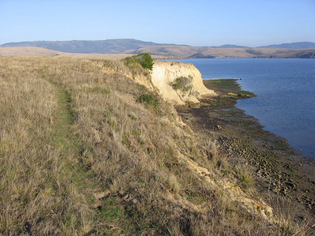 Found this unmaintained singletrack. Woohoo!
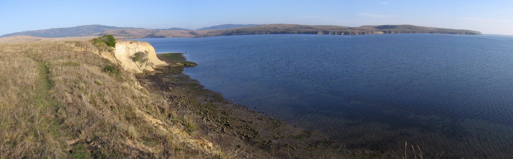 A wider view. The peak on the left is Mount Vision (1282 ft). It's twin on the right is Mount Wittenberg (1407 ft).
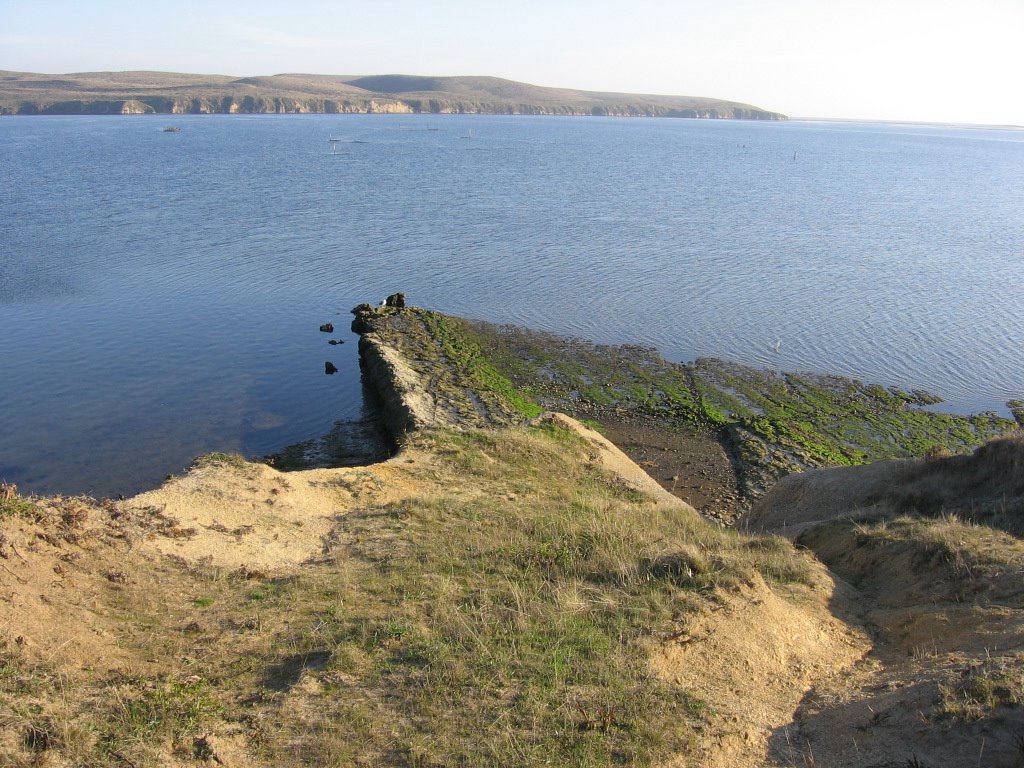 This slab of rock is most interesting. Is it part of a larger plane? Or just an odd slab that's more resistant to weathering than its neighbors?
 The rafts floating in the bay are oyster racks. From these racks dangle wires, which oysters latch on and grow for 18 months before being harvested and schucked for the market.
 Wider view. A trail on top of the cliffs across the bay runs to Sunset Beach. Much like their more majestic inland cousin, Half Dome, these cliffs blaze a brilliant orange when the sun goes down.
 Singletrack skirting the edge of a crumbly cliff. Simon says, "If you must fall, fall to your left." On the left is the opening to Schooner Bay and Johnson's Oyster Company.
All too soon, the enjoyable jaunt came to a close as this unmarked trail deadended at a fence with the sign, "Private Property. No Trespassing." Time to double back.
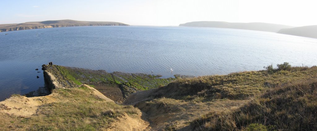
 Back at the official trail, the remainder of Bull Point Trail leads to this pocket beach.
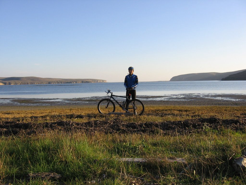 The cliffs of Sunset Beach on the left. The inlets of Creamery Bay and Barries Bay on the right. The opening to the Pacific Ocean in the center.
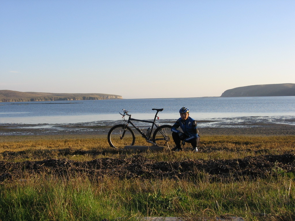 Moi.
Moi.Despite its brevity and proximity to the main road (Sir Francis Drake Boulevard), Bull Point Trail is remote. All I could see were hills, dales, ridges, bays, wildlife and cattle. Not once did I rest eyes on another person during the ride.
Epilogue:
Total distance: cyclo-computer 4.3 miles (6.88 km) / GPS 4.44 miles (7.1 km) / TOPO! 4.40 miles (7 km).
Total elevation climbed: Altimeter 329 ft (100.3 m) / GPS + TOPO! 225 ft (68.6 m).
Temperature range: 50 F to 56 F (10 C to 13.3 C).
Fluids consumed: 0 liters.

No comments:
Post a Comment