Finally received the GPS software and have been mucking around with it. Here are some of the results.
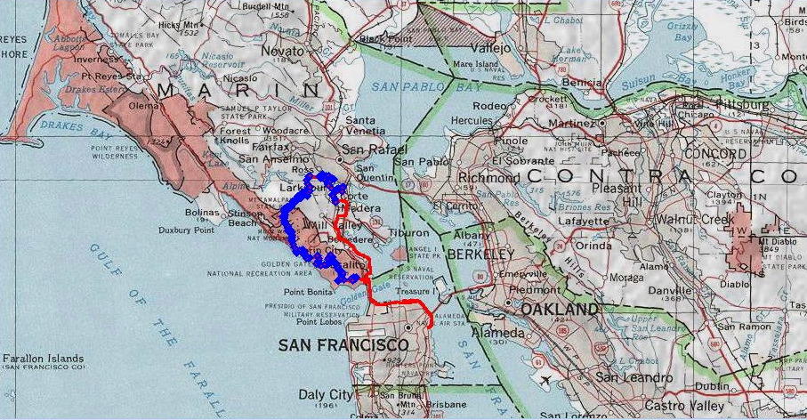 The red line is the entire route. The blue line, overlaying the red, is actually a large number of blue diamonds, each representing a discrete GPS trackpoint. For some reason, the GPS unit had more trouble maintaining a lock on the streets of San Francisco than on the mountains and valleys in Marin.
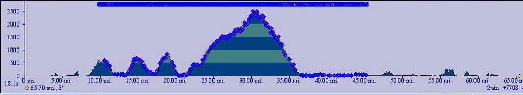 Elevation profile. The blue diamonds each represent a trackpoint left by the GPS device.
My housemate took the GPS data, fed to Goggle Earth, and obtained the follow interesting results.
 This a view of part of Coastal Trail descending from Coyote Ridge (elevation 900 ft) to Muir Beach (sea level). You not only can set the angle of the view, but the altitude as well. The "eye" here is looking straight down from 1437 ft.
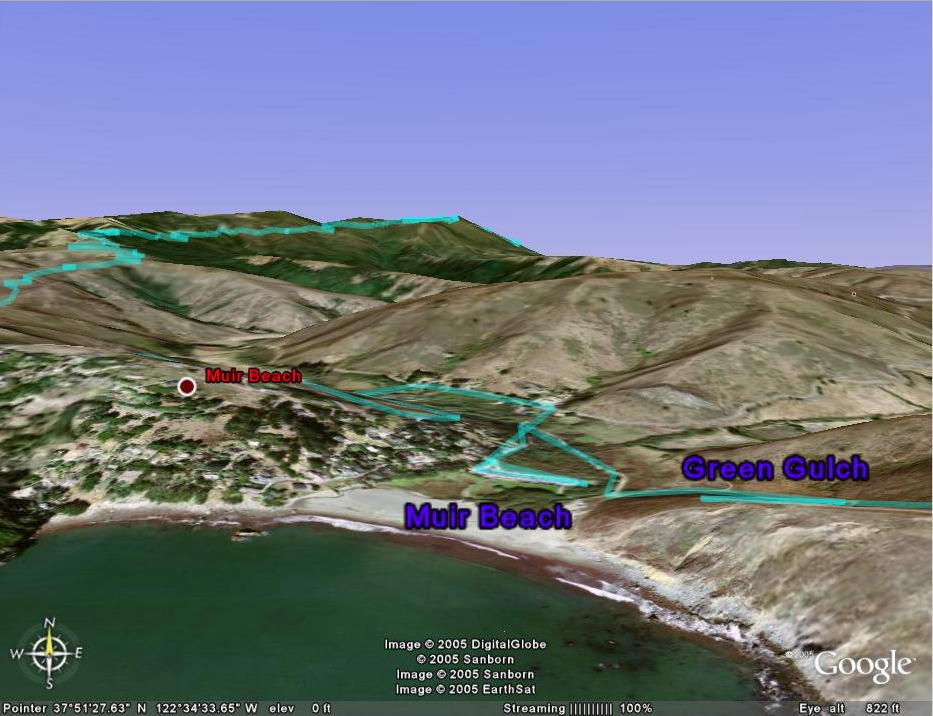 The "eye" is now at a theoretical altitude of 822 ft and looking east. On the right is the descent of Coastal trail to Muir Beach in the center, before climbing 450 feet up Shoreline Highway 1 to take Coastal trail (on the left) 2121 feet upwards to the East Peak of Mount Tamalpais. You can also see a little bit of Eldridge Grade as it winds down the flanks of the mountain.
 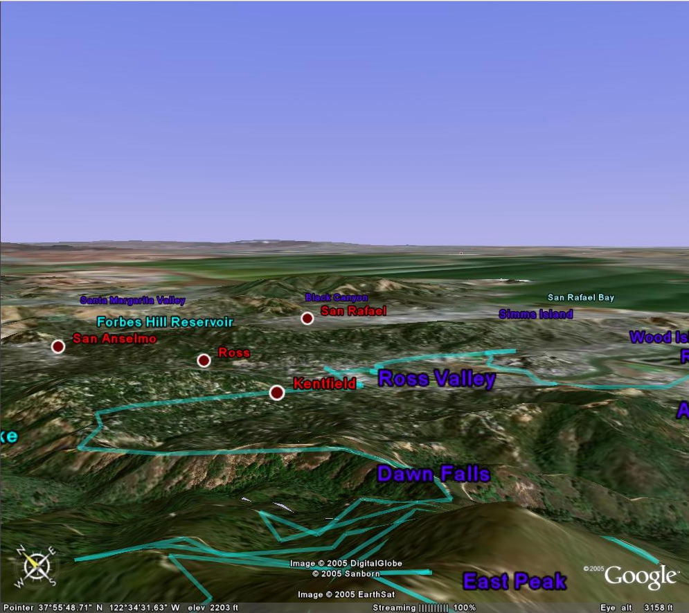 Eldridge Grade's torturous turns as it descends from the East Peak of Mount Tamalpais, as well as the giant rollercoasters of Old Indian trail (section after Dawn Falls).
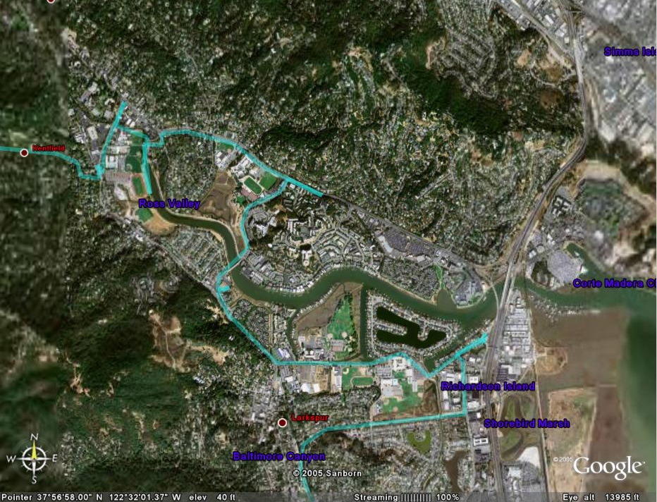 I find this especially humorous. Look at my tracks. Like a mouse in a maze. Yes, I was lost here.
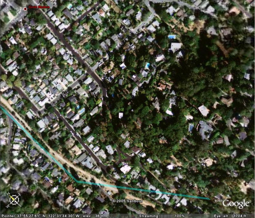 After 14 hours 9 minutes, the GPS device finally ran out of batteries.
 706 Meadowsweet Drive, where I stayed for the night.
Distance manually measured with map and mechanical mapwheel = 65.12 miles / 104.19 km.
Distance measured by GPS device and TOPO! = 65.70 miles / 105.12 km.
I guess I wasn't too far off :-)

No comments:
Post a Comment