Easy ride today: the Bear Valley Trail to Arch Rock.
 Map of the ride. 238 track points laid down by the GPS unit.
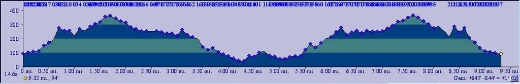 TOPO!'s elevation profile.
  Rigging up in the parking lot. It's 44 F (6.6 C) and it's windy and it's raining. But my cycling socks give me inspiration.
 Map at trailhead.
 Bear Valley Trailhead.
 And it was raining.
It was raining.
Can you guess which song that's from?
 A gentle climb to 368 ft. Helps to keep one warm too. An Ent guards the road on the right. (Look closely, doesn't it resemble a human face?)
 Fallow deer (Cervus dama), at Divide Meadow. Fallow deer are common in bushy hillsides and grassy fields. Their color vary from white to light brown to blackish-brown, with some possessing distinctive spots through adulthood. Their antlers have wide, flatten palms. Fallow deer are native to Asia Minor and the Mediterranean region. They were introduced by hunters, who favored the white variety as it made them easier to spot (and shoot). Looking at the bad picture (sorry, it's foggy and it's raining), how many blackish-brown and light brown deer can you see? What about the white deer?
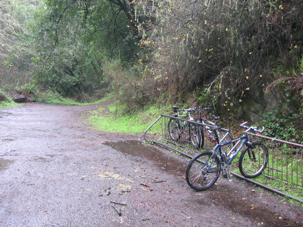 Bike rack. The final 1 mile (1.6 km) has to be made on foot.
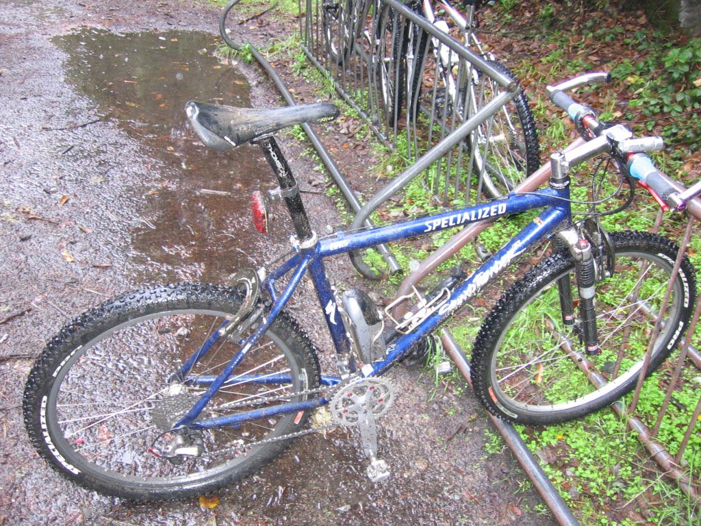 Fenders would have been a good idea.
 That's not just mud all over my bike, on my seat, my butt and back (not pictured). You see, the rain mixes horse crap, deer droppings, rabbit pellets, and fox poo with mud. And when a spinning tire goes over it... You get the idea.
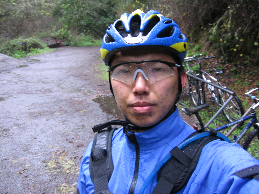 Moi.
Moi. Trail sign.
 That little sign carries a lot of weight. Trail poaching ("illegal riding") here results in a fine in the hundreds of dollars and the confiscation of your bike.
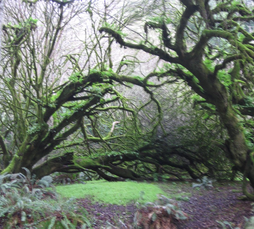 Entering Fangorn Forest. The cool dampness from the fog, mist, rain and dew results in a type of verdant growth that is distinct from tropical jungles. It is colder in here, about 39 F (3.8 C).
 Reaching the coastal area and leaving the forest. The rain stopped--temporarily.
 Ground becoming more sandy underfoot. Forest has given way to coastal scrub.
 Reaching Arch Rock.
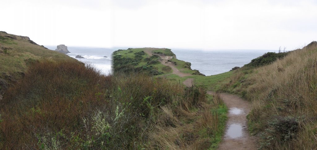 Wide view.
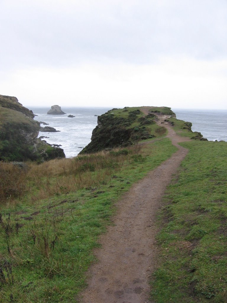 Final approach.
 Looking south at Millers Point.
 Closer view.
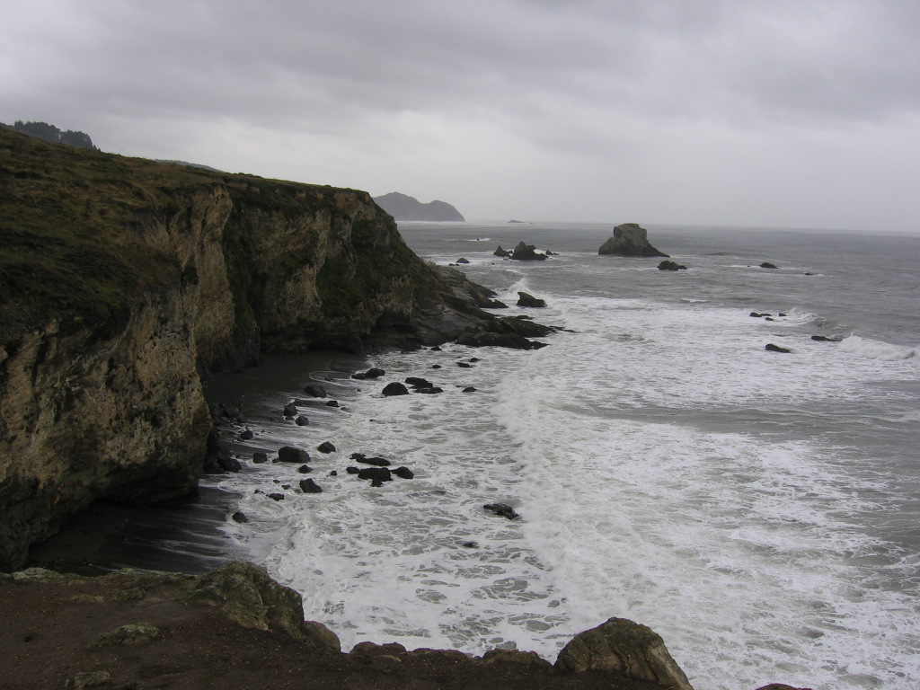 View from the top of Arch Rock. Storm clouds returning. Rain will resume shortly.
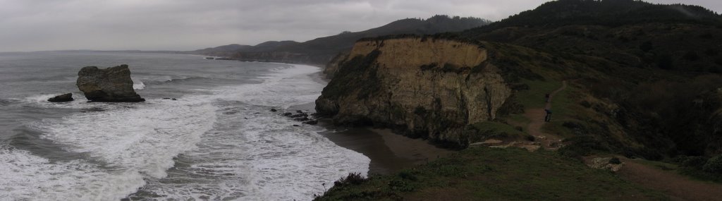 View north.
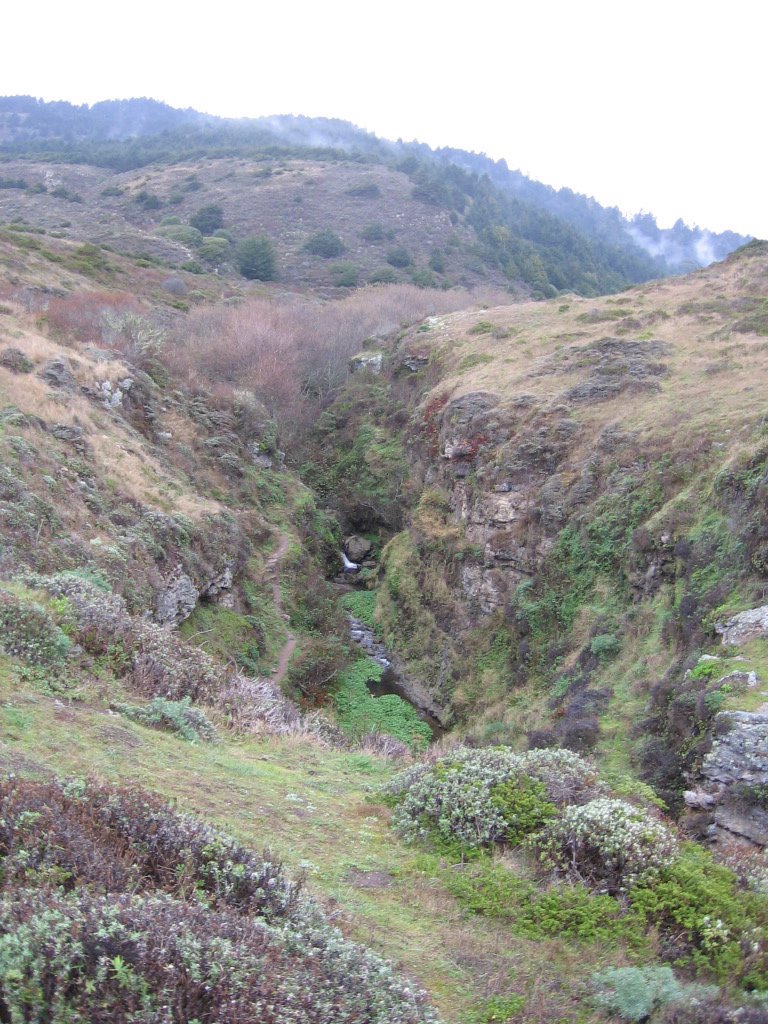 Coast Creek drains into the Pacific, cutting a canyon into the rock.
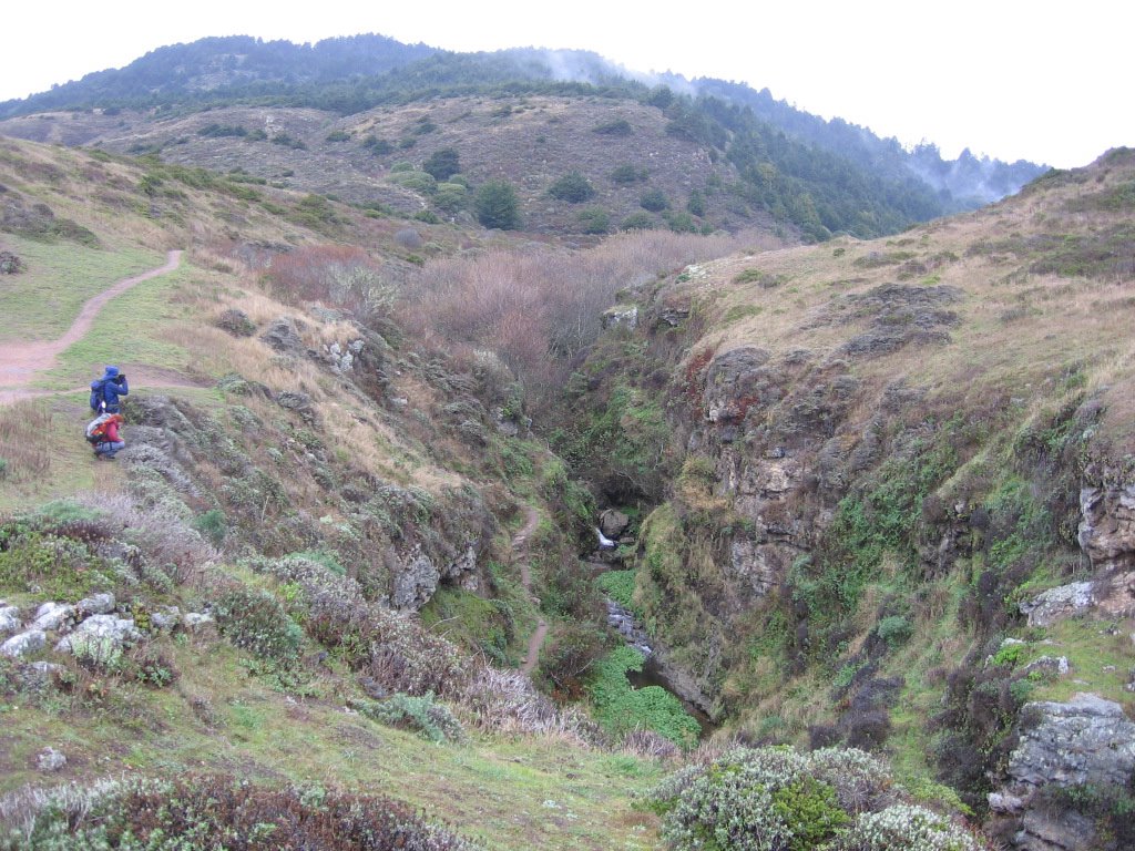 A couple of hikers contemplating the scramble down the canyon.
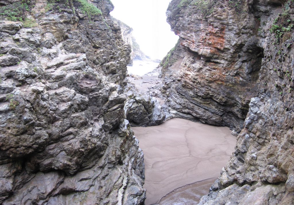 This spot marks the terminus of Coast Creek. Standing on the sand enables one to look through the arch at the bottom of Arch Rock, but it is a treacherous exercise: a big wave could wash in at any time and suck one out to the ocean. The steep canyon walls mean there isn't much room to run as well.
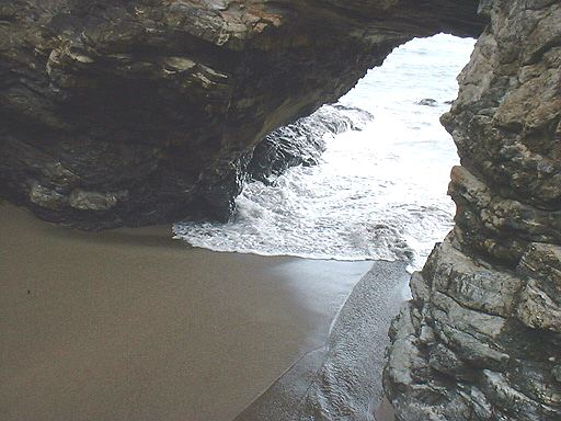 The Pacific rushes in through here to embrace the freshwater of Coast Creek.
  Looking through the bottom of Arch Rock.
 Returning to the forest (and fog and rain). The ride back to the car was a cold cruise downhill at 22.4 mph (35.84 km/h) in the rain and 40 F (4.4 C).
Epilogue:
Total distance: cyclo-computer 6.4 miles (10.24 km) + 2 miles (3.2 km) hiking / GPS 9.52 miles (15.23 km) / TOPO! 9.32 miles (14.91 km).
Total elevation climbed: Altimeter 660 ft (201 m) / GPS + TOPO! 845 ft (257.62 m).
Temperature range: 39 F to 44 F (3.8 C to 6.6 C).
Fluids consumed: 0 liters.

2 comments:
Holy shit what a beautiful ride! As I sat down to read I could feel my legs lifting and moving in a circular motion. Great area. I have biked those lagoons and backtrails on that peninsula for years, but I have never been under these great conditions. Damn great ride.
Thank you, Don Campanile,
Glad to hear from a fellow cyclist. Yes, it was beautiful. I was planning to do more rides. But the weather took a turn for the worse after the Bear Valley Trail ride and it was planning to stay that way for at least several days more, and so I went home. I hope to return there and ride the estero on a different route, the lagoons, and maybe a climb.
Post a Comment