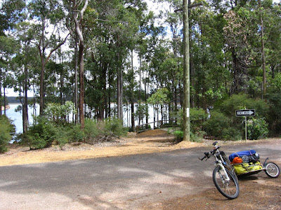
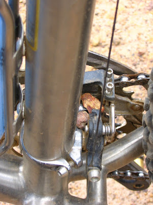
Lots of greenery today, so here's Sad Kermit (and Fozzie).


Blue line with yellow dots = Munda Biddi Trail.
Green line with yellow dots = Touring route.
Red line with yellow dots = route from Lake Brockman Tourist Park + unsuccessful shortcut.
Image for illustration only. Important information has been erased from this map. Do not use.


Elevation profiles.

'Slept well. Did not wake until 6:40 AM. Though I set the alarm clock to 7:30 AM, I decided to get up anyway.
'Had a cup of strong coffee, and 2 slices of gourmet, thoroughly squished, 5-seed pumpkin bread — toasted (a luxury).
'Patched yesterday's inner tube during second breakfast (pasta vegetariano).

'Took a long time to get the wounds dressed.

Maybe I should rename this tour to, "The Mummy Rides," or something.

The community bathrooms are situated about 100 m away.

The chalet.

The wooden ramp is quite treacherous when wet. It would be difficult to ascend or descend on cycling shoes without the handrail.

Lots of 28s or Australian Ringneck parrots (Barnardius zonarius semitorquatus) around. Here's a rather bad picture.

This leads to the camping ground (I think). It rained for several hours late last night. 'Glad I didn't choose to camp.

'Washed up the utensils and crockery, swept the floor of dirt (brought in by Cloe and Bob), and it was time to hit the road again.

'Didn't get to see Yukon this morning either (unlike Aushiker). He's a big, friendly 75 kg (165 lbs) Alaskan Malamute.
Started off at 11:25 AM.
Altimeter reading 1100 ft (335.4 m)
Temperature 27° C (80.6° F)
Sunny.

Glancing at the map, I figured I could shave 1.2 km of backtracking if I took a little shortcut coming out of Lake Brockman Tourist Park, and rejoin the Munda Biddi Trail later...

East shore of Lake Brockman.
12:37 PM. I ended up taking Scarp Road north by mistake. The (mis)adventure cost me an additional 8.42 km (5.3 miles), 160 ft (48.8 m) of climbing, 1 hour 12 minutes, a few thousand curses, and an unknown number of calories.
Realizing that you are not some über trailblazer / trail poacher?
Priceless.

10.14 km (6.3 miles) later: trailhead off Logue Brook Dam Road.
Back to the trail proper.
45+ km (28+ miles) to go.
Never say "Die" (just accept that you're dead).

To the right, descending to cross Clarke Brook is Blackburn Road.
At this point, the Munda Biddi Trail narrows, heading straight.

A curious young tree beside the junction.

This part of the trail is really fun.

Twisty.

Turning.

Rollicking.

Like that. Yeah.

Getting onto an unsealed road.

Tree harvesting in operation.

A closer look.

Crossing Clarke Road.


Egads! We've 2 stowaways!

Trees meant to be harvested are marked "H." Those that are to remain standing have an "X." (I think.) Anyone who disagrees may wear black, with the letter "H" emblazoned, and stand in the bushes.


A nice grove of replanted trees.

Asphalt!
A couple of utes and a Land Rover roared past as I was composing this picture.
Why do flies go for your eyes?
Same reason why psycho chicks stake out men, Sonny — they like to drink your tears.

Back to dirt.

Bush Boronia (Boronia fastigiata Bartl.).

Back to narrow forest tracks.
*Crunch!*
*Pop!*
*Tinkle!*

Some sections a little more so.
*Crack!*
*Whip!*
*Curses*


'Found a feather from a female Red-tailed Black Cockatoo (Calyptorhynchus banksii naso) on the trail.


Through the day, drifting clouds give occasional shelter from the sun.

Flowers are pretty, bees get mad, I pedal faster.
Eye protection recommended.

5:17 PM.
38.67 km (24.2 miles) later, time to break out my first packet of energy gel of the tour.


Something lies ahead, beyond the glowing Gold Water Bush (Bossiaea aquifolium Benth.).

Something massive.


Backtracking, I found a trail, which climbs up and around the fallen tree. Whew! So, this is not a cyclo-cross track after all. Disassembling Cloe and Bob, unpacking the bags, to get over the huge log — and then re-assembling and re-packing everything — would have taken an awful amount of time.

Another one ahead. The much smaller log allowed the option of dragging my rig over.


'Guess I get to explore Tag Road more then.

The detour goes through a pine plantation.

Like living, green steeples.

Or, a giant garden labyrinth.


It only grows harder, only grows hotter...
...he's known as the globetrotter
Lonely roads, God only knows

It took 5 attempts to get this picture with the Canon A510.
Whereas you need a bit of experience in packing panniers to get the bike well balanced, the BOB enables anybody to throw a heap of gear in willy-nilly since everything is in one big bag. But, the disadvantage is that, without fail, the thing you want will be at the bottom of the bag!("Ask Betty." Munda Biddi Messenger [Perth] 8 (Summer 2004-05): 6.)
The image-stabilizer enabled Canon A590 IS is safely stowed in the Bob Dry Sack (at the bottom of the trailer).

Some images though...

...make the day's ride worth it.

7:05 PM.
The forest turns green, gray, black, and gold.


30 minutes more of this.

Bingo!

Yarri Campsite.
Journal entry
After a misguided attempt at a shortcut today, I wasn't really sure if I would make it in time before dark to Yarri Campsite. I prayed. Man, I prayed. And I rode. And rode. Hard. I burned through all 7 muesli bars by 4:15 PM. I had one pack of GU energy gel in the pack; that's it. After 5 PM, I was running on fumes. Every (non-technical) downhill was a prayer answered; every hill, a test of faith.
After a confusing, overgrown section before Myles Avenue, where I thought I was doubling back on the same trail (having the compass indicate it didn't help) — I was actually looking for my tire tracks in the dirt as I huffed and puffed — and a nice 2+ km rollicking downhill at 30 km/h, slip sliding with a 39.7 kg (87 lbs) trailer, I reached Yarri Campsite. Hot drinks and food never tasted so good.
Similar to my experience with the other 4 huts, I'm the only occupant for the night again. Surrounded by Western Australian Blackbutt eucalyptus trees (Eucalyptus patens), the hut is lovely. The benches are easily twice the length of the ones in the other huts, and seem to be shellaced. The sleeping platforms are smaller. 'Will find out tonight how much they protect from the wind. Only had one injury today — no crashes (that's a record in itself) — a pedal smack which reopened a healing wound, despite the protection the band-aid offered.
The descent through the dense bush from Logue Brook Dam Road was glorious, but, being in too much of a hurry to cover ground as fast as (safely) possible after the failed attempt at a shortcut (which had me unknowingly doubling back up north on the eastern shore of Lake Brockman via Scarp Road), I didn't set up the lipstick cam to record it. That, and the trail was swarming with ants — not exactly an attractive place to set your feet down to rig up the video camera. There were at least 5 to 6 minutes of good descent along moderately twisty singletrack, as well as straight barrel runs — shooting down corridors of prickly green foliage (as well as the occasional, murderous, low-hanging branch). Later, against better judgment, I gave in and tried to make up for the lost footage by filming two much shorter — and tamer — runs.
As I was pressed for time (this is the longest ride of the trip so far), not many pictures were taken today, but I did manage to shoot a few scenic images. I hope they turn out (some didn't, due to the lack of image stabilization in the Canon A510. Again I should have carried the Canon A590 IS in my Camelbak™). There were more than a few that got away, not because I was too tired to snap them, but because capturing it exceeded my 3-year-old compact camera's specifications (or my technical ability).
'Filled in the logbook but I'm too tired to pen a comment in the Comments Book tonight. 'Will do it tomorrow. Though it's not raining (unlike the stay at Bidjar Ngoulin Campsite, 2 days ago), I'm not even bothering with brushing my teeth tonight. Maybe my resulting dragon breath will kill a few thousand flies tomorrow. Time to unroll the sleeping bag and head to dreamland, where it never rains; is never too hot or cold; tires never flat; and the trail is always, always, downhill. Cheers.
-11:09 PM

DATA
Start 11:25 AM
End 7:45 PM
Total 8 hours 25 minutes
Cateye AT-100
Altimeter reading at Yarri Campsite 805 ft (245.4 m)
Elevation climbed 1800 ft (548.8 m)
Distance 34 miles (54.4 km)
5 hours 25 minutes 37 seconds
Average speed 6.2 mph
Maximum speed 26.6 mph
Temperature 17° C - 27° C (62.6° F - 80.6° F)
Cateye Enduro 8
5 hours 13 minutes 43 seconds*
Average speed 10.5 km/h
Maximum speed 42.5 km/h
Distance 55.18 km
Cumulative distance 343.53 km (214.7 miles)
* = The Enduro 8 doesn't appear to keep time or give a speed reading below speeds of 3.6 km/h (2.25 mph). E.g. when I'm pushing Cloe and Bob up steep hills. Distance, however, continues to be tracked.

No comments:
Post a Comment