Travel only with thy equals or thy betters; if there are none, travel alone.(Dhammapada)

Blue line with yellow dots = Munda Biddi Trail.
Green line with yellow dots = Touring route.
Red line with yellow dots = route to Lake Brockman Tourist Park.
Image for illustration only. Important information has been erased from this map. Do not use.


Click here for metric units.
Aushiker also did this ride and posted GPS tracks of this section :-D

'Woken up at 6:30 AM by a hardcore march fly (WTF? It's 12° C! It must be somehow related to NicIz2HardKore or something), so I burrowed deeper into my sleeping bag for cover and dozed off until the alarm rang at 7 AM (13° C).

Breakfast by Federal Gully Brook.

Light from the morning sun streaming into the gully.
The heavy rain through the night really gave everything a drenching. Hopefully, it will provide the flies with enough moisture, and they will quit annoying me.
Rant on.
(Skip ahead to the next image if you don't wish to read this.)
8:13 AM. Looking back over the trip — I've been on the
What amazes me then (it no longer amazes me now) is the sheer number of people advising me to wait on this trip; wait until the entire Munda Biddi Trail is complete; wait until you've gained more weight, muscle, fitness, et cetera; wait until the Singapore gahmen (government) convinces Australia to let them micro-manage every aspect of this trail and idiot/moron-proof it: exterminating all the nasty insects, venomous snakes, big spiders; tagging and issuing RFID cards for all kangaroos, wallaroos, and wallabies; installing guard rails and lamp posts along the entire trail; and employing puerile prurient park rangers to protect my genteel sensibilities from properly attired elderly males.
fortycalibernap visited Singapore and observed that the locals are afflicted with a crippling inertia — they wait. They complain, whine, and they wait. They wait for other people to do things for them. They wait for the government to implement social/business programs for them. They wait for social programs to match-make them. Then, they wait for handouts to spur them to reproduce. Even on vacations abroad, a significant number — if not the majority — of them embark on group tours: their itinerary all planned out — and safe; comfortably ensconced in crass, poorly-worded, mass produced, treacle, they are corralled by mini-Eichmann tour guides, who dictate, right down to the minute their hourly (or even half-hourly) schedules. Enjoy your bus rides and change parades, folks.
On the issue of waiting, Chris posted a great comment on a recent tour, but I never found the opportunity to respond in a manner that would do justice to it. During yesterday's easier ride, I had plenty of time to ruminate, so here's my response:
On the issue of waiting, I agree with Chris. Why wait? Why not now? You've prepared as much as you can, and you go. Wait for what? Wait for who? (Remember, I generally prefer to travel alone.)
Wait. While you wait, time passes you by; opportunities pass you by; and, day by day, you grow older, less fit. The longer you wait, the higher the chance of life / misfortune / evil, overbearing, paternalistic governments throwing a wrench in your spokes, turning your planned trip into a permanent dream.
So . . . wait. Wait until when? Tomorrow, next week, a month from now, a year from now, you could be hit by a truck, a murderous cab driver, an ah beng distracted by his ah lian, or some tai-tai reaching for her cell phone behind the wheel. Then what? Be the next poster child for fraudulent charities seeking donations from
Or, someone you love, or are close to, could be struck by a terminal illness, requiring you to provide (or support) palliative care. How are you going to ride then? When are you going to ride?
Sure, there are older folks who have done this trail (and countless others) but I rather do it now when I'm (relatively) young. At the end of the day, my position towards unsolicited advice is this: if I desire your opinion, I'll ask for it; I inform out of courtesy, and am not seeking advice, direction, approval, or your blessings.
So, while I ride, they wait*. I go on adventures; chalk up rides; grow with each adversity, learning to be grateful for each serendipitous act of generosity or stroke of luck — they wait. They can wait then. Until they are in their seventies, then they can wheel their tours around food courts — clearing trays**.
-9:12 AM
Federal Gully Brook
* = FWIW, the folks who advised me to wait on my Thailand-Singapore Ride are still waiting, what with their litany of excuses: political unrest, racial tensions, economic downturn, floods, inclement weather: too wet because the monsoon is here; too warm because the monsoon is over; their pants are too tight, blah blah blah...
** = Personally, I think it's disgraceful to hire geriatrics to clear trays and dishes at food courts; if you are not disabled, you are capable of clearing your own tray. Allowing this practice to flourish is an exercise in hidden unemployment and enabling moral decay.
Rant off.

Plenty of water for a morning wash :-D

Note to self: never have a dinner involving tuna; neglect brushing your teeth (Hey, it was pouring, and I didn't want to soil the area around the hut); and then go to bed dreaming of steak and potatoes all night — I woke up to discover eau de poisson (overnight and dolphin-safe) drool on my sleeping bag. Oy vey!

As there was no one else at camp (and I can hear anyone approaching from far off — loose pea gravel crunches loudly), I did not close the door. Midway through, a kangaroo stopped by, brazenly looked in, and then went on its merry way. *THUMPA!* *THUMPA!*
Crikey! The signs warn of roos crossing the road, but no one let on that they are scatological voyeurs too.

You're likely to have the Bidjar Ngoulin shelter, which is close to a gurgling stream, to yourself apart from the truly enormous spider that hangs near the dunny roll in the toilet.(Claire)
Ye-ep, the big fella is still there ^_^

This crawled across my foot as I was packing. Man, Bidjar Ngoulin is insects galore, isn't it?

Maintenance issues
Tightened bolts on camera tripod: 9 days of rattling on top of the rear rack loosened all the screws.
Black Diamond Apollo™ LED Lantern ran out of power (Energizer™ lithium) last night. 'Expected it to last the entire trip. Perhaps it is not current regulated.
Gerber Tracer™ LED Headlamp (non-current regulated) ran low on its single AAA Energizer™ lithium battery as well.
Here's Black Diamond's position on non-rechargeable lithium batteries:
Thanks for checking in with us. Though it is ok - and does not void the warranty - to use Lithium Ion batteries in our headlamps and lantern, we only recommend doing so in colder temperatures (32 degrees F or colder) as this offsets the amount of heat produced by the batteries themselves. Use of Lithium batteries in warmer temperatures could (read: possibly) result in the damage of your lamp, and thus we recommend not using them as your "everyday" battery. I hope this information is of help.(Candle Power Forums)

An unfortunate spider napping on one of Cloe's tires last night discovers to its sorrow that rubber is not always 100 percent safe.

Set off at 11:55 AM.
Temperature 21° C (69.8° F)
Altimeter reading 1085 ft (330.8 m)

It has been like that for the last 10 km (6.25 miles).


12.23 km of easy trails. It has been nice. I've learned to ride comfortably with one hand whilst towing a 39.7 kg (87.3 lb) trailer and a 7 kg (15.4 lb) backpack — and even managed brief sessions of hands-free riding as well :-D

Soon, I shall be able to carry out brain surgery in much the same manner. Sign up now. 50% off and a free brain for the first 5 customers.


Zig Zag Road.

At Sixty-One Mile Form and contemplating a detour to Willowdale Arboretum.

Hmm...
Left, needless detour; straight, less riding.

Needless detour, it is :-P
Rising on a slight incline, the detour to Willowdale Arboretum follows Samson Brook.

2:30 PM.
16.49 km from Bidjar Ngoulin, and 267.45 km from Mundaring...

... my first flat.

In my infinite wisdom (to save weight off my back), I packed all the spare tire tubes in the bag that's — naturally, of course — at the bottom.


Kicking yourself in the (___*___) is a fine art solo touring cultivates.
'Also discovered the front non-drive side brake shoe was creeping upwards. The V-brake pad retaining pin was in danger of slicing open the tire sidewall. 'Had to rectify it with a whole bunch of flies buzzing in my face, and 3 vicious march flies. Fun.
March flies are known to be attracted to dark blue, so it is advisable to avoid wearing blue and other dark colours.(Department of Health, Western Australia)
Guess what color is my jersey?
Damn it!
Finally set off again at 3:15 PM.


At Willowdale Arboretum BBQ Pit area, I discovered pellets on the side of the restroom.


3:36 PM. Back to the junction. The little exploration cost me 1 hour and 21 minutes.
So much for a quick and dirty detour.
Dirty, yes. Quick, no.

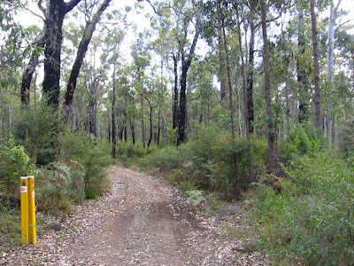
Just the sound of wind and birds.
(Okay, and #@%&!!! flies)

Intermittent rain lowered the temperature to 18° C (64.4° F).


Here, Waterous Trail breaks off from the Munda Biddi Trail, heading north-west towards Lake Navarino Forest Resort, 17.1 km away.

While trail bikes (i.e. dirt bikes, scramblers, motocross bikes) are not allowed on these trails, they do find their way in. The result is ripped up trails, deep ruts, and gravel that render the trail unridable for cyclists. Personally, I find having to push the bike along level ground (due to deep, unridable gravel) more demoralizing than up steep inclines. At least with the latter, you can brag, "I swear, dude! It was this steep!"

5 PM, Cowna Road.
An Emu (Dromaius novaehollandiae) saw me approaching and high-tailed out of there. I tried to keep up, but damn! though my speedometer read 45 km/h (28 mph), it was still pulling away from me. My reputation precedes me. (Do I really smell that bad?)


Overshot this sharp left turn, but, by now I knew better than to slam on the brakes, jackknife the rig, and get thrown off (again); so, I stopped as soon as I could and u-turned back.


The burnt forest after Cowna Road was surreal: as if from another age, huge, burnt trees, black, twisted, and broken, lay strewn everywhere; others, clinging to ash and dust, wept sentinel, shredding tremulous skies with spires darkened, like shards from some Gorey-esque nightmare.
I gotta stop hanging out with the emo crowd, or watching Peter Jackson's Lord of the Rings — or both.


Blackboy (Xanthorrhoea preissei) flowering.

Crossing one of the numerous unnamed brooks that drain into Lake Brockman.

Looking back at the cool, clear, clean water (longingly).

After pushing up a short — but steep — slope after Scarp Road (2nd hill).

A closer look. This area belongs to a private resort (I held my camera over the barbed wire fence).

A curious wallaby looks on as I enjoy a rooty downhill to Lake Brockman.

Lake Brockman Picnic Area. As I checked my bearings, 2 carloads of teenagers pulled up for a BBQ and picnic (despite the intermittent rain). The wonderful chaps offered me a beer but as I needed my wits about mustering Cloe and Bob, regretfully, I had to demur :-(

Valley west of Lake Brockman.

A wider view.

7:30 PM.
14° C (57.2° F) and sporadic showers make for a wet, chilly ride.


Logue Brook Dam.


Western shore of Lake Brockman.


I believe that's Logue Brook Dam Road, heading west towards the South Western Highway.

Journal entry
Despite the intimate picnic spot at the tranquil, bubbling brook, and the dainty waterfall, Bidjar Ngoulin (the phrase means "place of rest" in Nyoongar) was an unsettling place to overnight alone at. It began in the late afternoon innocuously enough — hordes of black flies; and then later, much more painfully, march flies. But something changed when night fell. Larger fellas started coming out of the woodwork: tarantulas (that charge rather than scurry away when shooed off), and their fanged counterpart, centipedes. Then, it started to pour. Yes, I'm grateful I'm not camping in a muddy pit by the Murray River, but there was something unsettling about the place here. The wind and rain picked up, and (I kid you not) I could hear angry murmurs and voices through the night — over the wind and rain. In a forest, with the heavy rain and darkness all around me, I had nowhere else to go. I may startle now and then, but I don't get frightened easily; and I can honestly say that I was spooked last night: I slept wearing a rosary round my neck.
Later in the day, around 2:15 PM, at the junction of Sixty-One Mile Form and Zig Zag Road, I took a gamble and detoured to check out Willowdale Arboretum since it is part of the Munda Biddi Trail. 15 minutes into it, I had my first flat of the tour. Changing it with hordes of march flies trying to bite you is fun. When I finally reached Willowdale Arboretum, it was deserted (no surprise, really). While checking out the BBQ area, I noticed pellets embedded in the outside of the restroom walls. I quickly got out of there, and though there is a shorter way back to the Munda Biddi Trail via Willowdale Road, I opted to stay out of the main (unsealed) roads and and double-backed on forest tracks instead.
'Got rained on repeatedly throughout the day. Never long and strong enough to soak me, but enough to sap my energy by lowering my body temperature. It also made handling my non-weather-resistant Canon A510 a pain. The Olympus Stylus Tough 8000, the Canon Powershot D10, or the Pentax Optio W60 (which was sent up into the stratosphere by 4 Spanish high school students), would make great backups in such instances.
Despite clearly trying to make good time, a lot of picture opportunities cropped up. I spent 15 minutes trying to compose a picture in a forest of dead trees. (That came out well.)
Later, I spent another 15 minutes rigging up the lipstick cam to capture the reaction of wallabies to my approach. (This obviously didn't.)


The sunset over Lake Brockman speaks for itself. It was 14° C (57.2° F), I was cold, damp, and tired, but the images were worth it.

A short but rather steep climb later: Lake Brockman Tourist Park. The choice of accommodation available: chalet or campground. No prizes for guessing which one I chose.

Despite the late hour, Mrs. Brown cheerfully attended to me, even inquiring with concern if I have food to cook dinner. On the way to my chalet, I tried to catch a glimpse of Yukon, the cyclist friendly dog, but to no avail.
The unit has a full kitchen, save for a convection oven. I put my stuff down, cooked 3 packets of instant noodles; wolfing each bowl as the next boils to perfection, not bothering about anything else. (Thus, my apologies — no pictures.)
I wasn't offered linen (nor did I remember to ask), but there is an electric heater. I am a trifle lazy to unstuff the sleeping bag tonight; maybe, together with my merino wool-based layer, and a silk sleep sack, I may not require it.
'Going to wash today's clothes now, and then turn in. 'Wonder if I am up to ride tomorrow.
-11:37 PM

DATA
Start 11:55 AM
End 8:20 PM
Total 8 hours 25 minutes
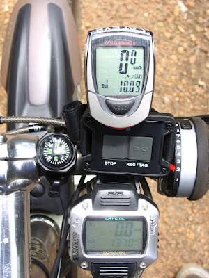
Cateye AT-100
Altimeter reading at Lake Brockman Tourist Park 1140 ft (347.6 m)
Elevation climbed 1270 ft (387.2 m)
Distance 23 miles (36.8 km)
3 hours 50 minutes 45 seconds
Average speed 5.9 mph
Maximum speed 21.7 mph
Temperature 12° C - 21° C (53.6° F - 69.8° F)
Cateye Enduro 8
3 hours 39 minutes 31 seconds*
Average speed 10.2 km/h
Maximum speed 35 km/h
Distance 37.4 km
Cumulative distance 288.32 km (180.2 miles)
* = The Enduro 8 doesn't appear to keep time or give a speed reading below speeds of 3.6 km/h (2.25 mph). E.g. when I'm pushing Cloe and Bob up steep hills. Distance, however, continues to be tracked.

4 comments:
"Travel only with thy equals or thy betters; if there are none, travel alone." (Dhammapada)
I like this travel advice.
Hi QQ!
:-)
Simply love this post!... Especially on the issue of waiting. ;)
Thanks for dropping by, Zila!
:-D
Post a Comment